These are the bridges and tunnels headed west on the West Penn Trail through the Conemaugh River Lake Section and touching into the Bow Ridge Section. This is a 1907 rail line that contains a total of five massive cut stone arch bridges, one trestle bridge and two blocked tunnels cut into the Bow Ridge mountain.
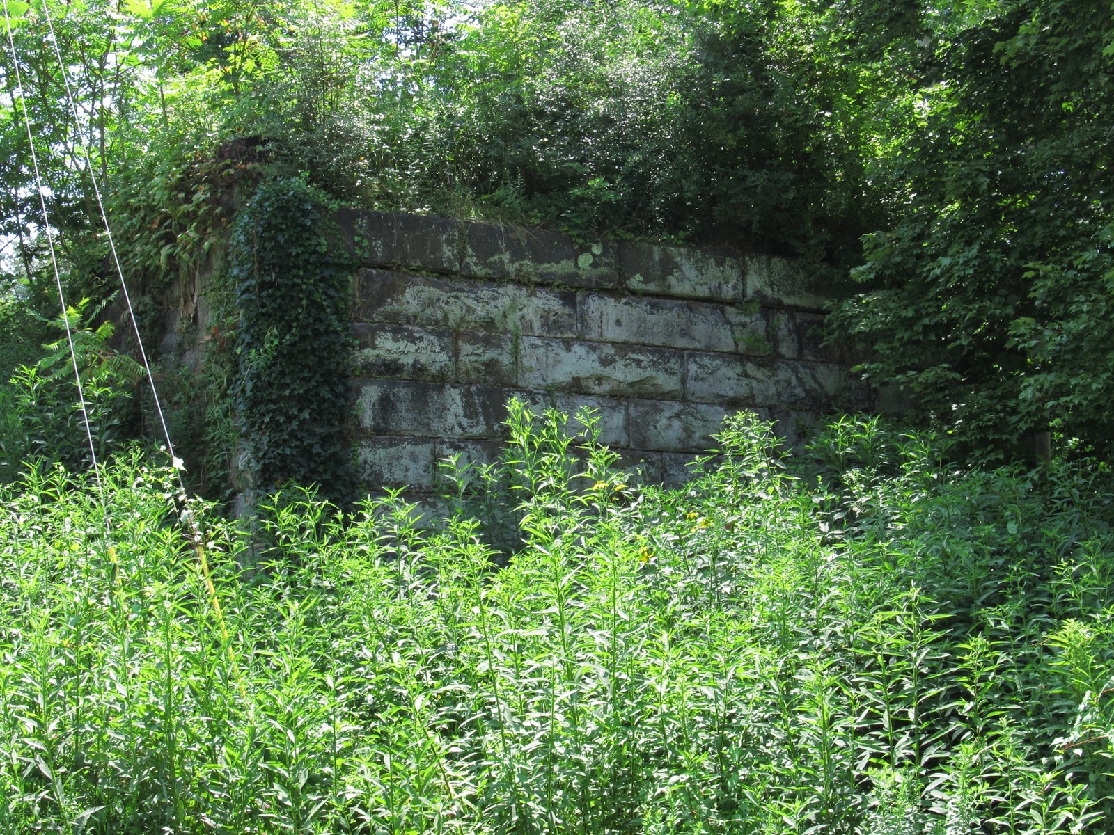
This is the first of the bridges starting from the east, a trestle bridge called the Social Hall Bridge, named for the former town of Social Hall.
 |
A picture of the modern railway bridge taken from the old Social Hall bridge.
|
 |
| This is part of an older bridge crossing the railroad from an old alignment of Westinghouse Road. |
 |
| The Social Hall spring that tunneled water away from the older rail line. |
 |
Headed down the trail to the next bridge.
| |
|
|
 |
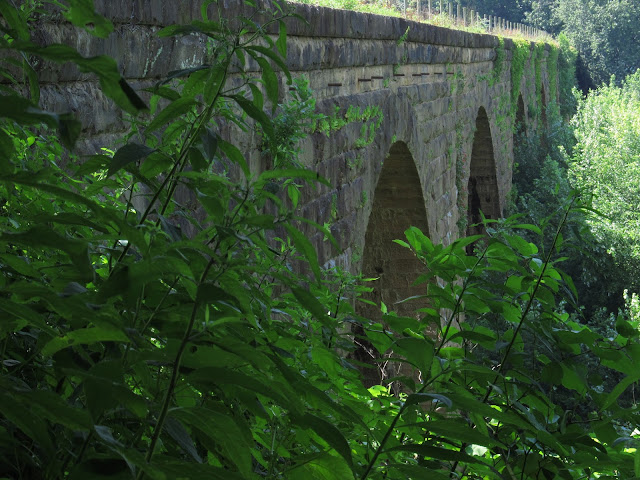
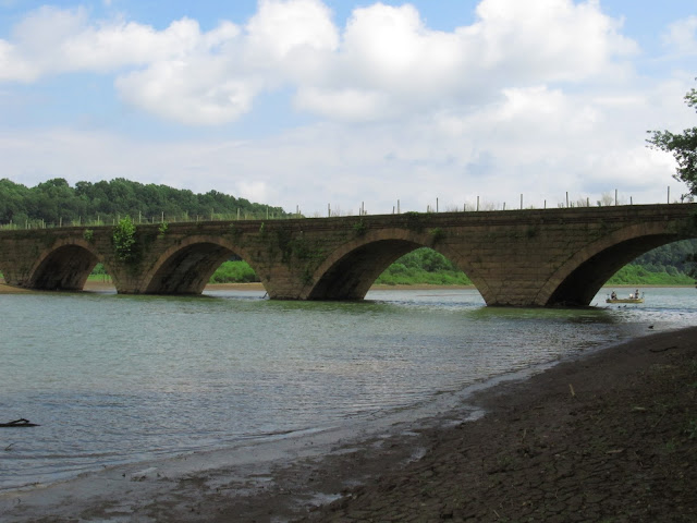
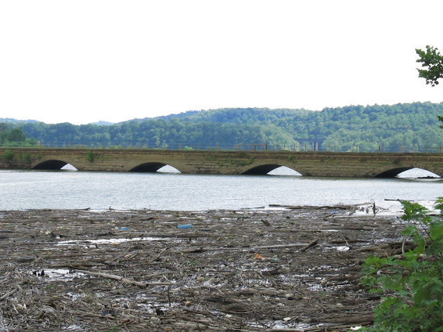
| This is the first of the stone arch bridges. An interesting bit of history about these bridges: Around 1916 these bridges required extensive maintenance. The masonry work had not been properly sealed due to the assumption that the drainage system installed would remove water draining through the ballast stones. The pipes of the drainage system became clogged or froze forcing the water between the stones of the bridge. The thawing and freezing of the water began to damage the stone. All traffic was moved to one side of the bridge, the rails and ballast were removed from the other side. Once removed, the interior of the stone arches were sealed allowing improvements of the drainage system and preventing water from seeping between the stones. When one side was finished the process was reversed so the other side could be finished. It must have worked and continues to work to this day. Nearly 100 years after these bridges were sealed they still stand today in incredible condition. |
 |
| Amazing architecture. |
 |
| A view of the river from atop the bridge. |
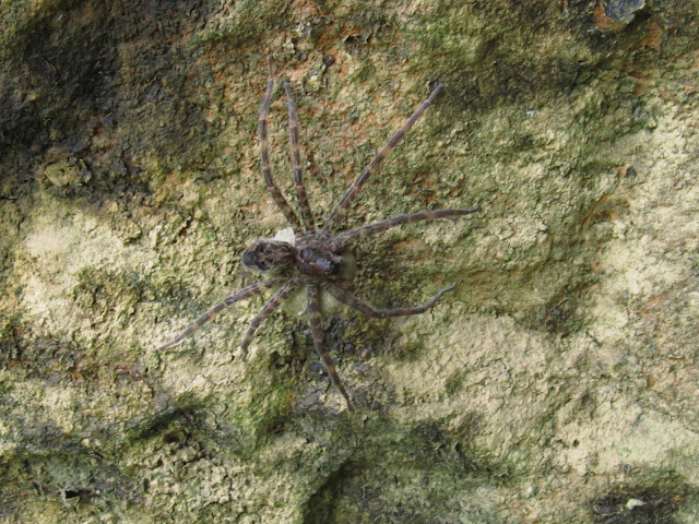 |
| One of the inhabitants that live under the bridge. |
 |
| This bridge is absolutely massive. |
|
LIVERMORE
Livermore was an old canal town established in 1827 by John Livermore who I am assuming was a relative of Alonzo Livermore, Asst. Engineer of the Western Division of the Pennsylvania Canal. The town was dismantled in the 1950's as part of the Army Corp Of Engineers Conemaugh Dam flood control project. Nothing remains of the town today and it is under water when the river is high.
At it's heyday the town contained hotels, numerous businesses and churches, residences and was a stopping point for travelers on the mainline canal. Charles Dickens is reported to have stayed here while traveling on the canal in 1842.
For kids growing up around here Livermore was the stuff of legend and mystery. Many myths surrounded the town and it was often a rite of passage to visit at night long before this trail was open. It was rumored that the town was pretty much flooded over night, none of the towns people had an opportunity to escape and the buildings were left intact. It turns out that none of that is true but coming back here late at night, crossing the tracks and coming to the gate left a lot to the imagination and was pretty eerie. I loved every second of it! Many kids walked down to the bridge only to turn around and go running back to the car.
Livermore Cemetery sits on top of the hill and another rumor was Night Of The Living Dead was filmed there but it wasn't. It was filmed in Evans City several miles northwest of here.
Livermore Bridge is the second of the massive stone arch bridges.
This is an early map of Livermore:
 |
| Early map. |
 |
| New trees growing out of the mud in the flood plain of what was once Livermore. |
 |
| This plaque is on the side of the bridge commemorating the engineers and contractors. A.C. Shand's name appears on the 1907 tunnel further up the trail. |
 |
Underneath the enormous bridge.
|
 |
| What downtown Livermore looks like today. |
 |
This is part of the bridge that led out of Livermore to the town of Filmore across the river. Filmore was a smaller town but shared the same fate as Livermore.
|
 |
This is looking toward the former site of Livermore Station.
|
|
 |
| A 1908 photograph of Livermore Station. I don't know of any others of the town. |
|
I have more photos of Livermore Bridge in an earlier post on this blog.
Now on to the third stone bridge.
 |
| This is the second bridge before the dam. The bridges are all the same height. Notice how the water level keeps rising as we get closer to the dam. |
 |
| These are old bridge supports from the 1854 rail line. |
 |
| Notice that the closer we get to dam, the more submerged the bridges get. |
 |
| Guys fishing under the bridge. |
 |
| A wide view of the 1854 bridge remains. |
Now onto the final bridge before the dam.
 |
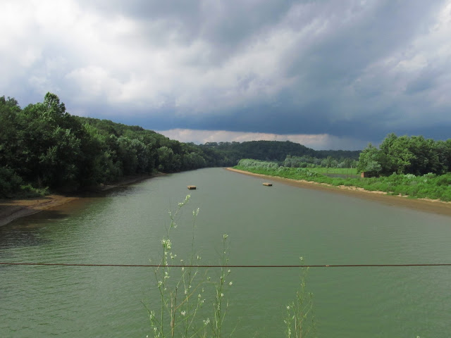
Heavily flooded.
|
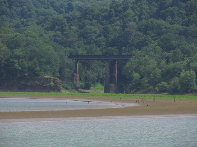 |
| This is a bridge on the modern line. The current railway was chartered in 1950 and elevated to remain unaffected by the flood control project. This was taken from the last stone arch bridge before the dam which I would imagine gets completely submerged at times. | |
|
TUNNELS
There are a total of three tunnels that go through Bow Ridge. The first tunnel was built in the 1820's and served the mainline canal. Today, that tunnel is deep under water but it has the distinction of being the third tunnel ever built in America. The second tunnel was from the 1854 rail line and the third was from the 1907 line. All of these tunnels have been plugged in the middle with 20 feet of concrete to prevent water flooding through them and bypassing the dam.
 |
| This is all that remains of the eastern portal of the 1854 rail line tunnel. This tunnel was built in 1864 and it wasn't until 1871 that the railroad reached Saltsburg. It is almost completely swallowed up by the hillside. |
 |
| A.C. Shand designed this tunnel too. |
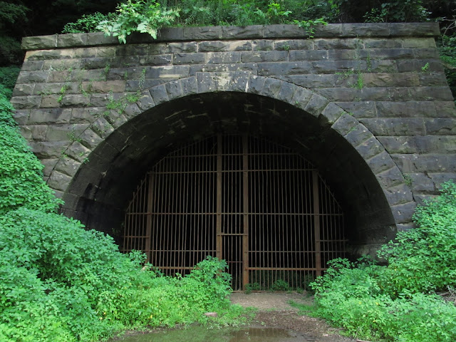 |
| Eastern portal of the 1907 tunnel. |
At this point in the trail you have to climb a set of stairs on the side of the mountain and ride/hike to the other side.
 |
| The western portal of the 1907 tunnel. |
|
|
 |
| The western portal of the 1864 portal. |
 |
| Conemaugh Dam. |
 |
| The modern 1950 rail bridge passing over the last of the stone arch bridges on this trail. | | | |
|
 |
| The last, and in my opinion the most impressive of the stone arch bridges. Notice the curve of this enormous bridge. |
 |
| This is a remaining portion of the old main line canal. |
Update! 1/31/2014
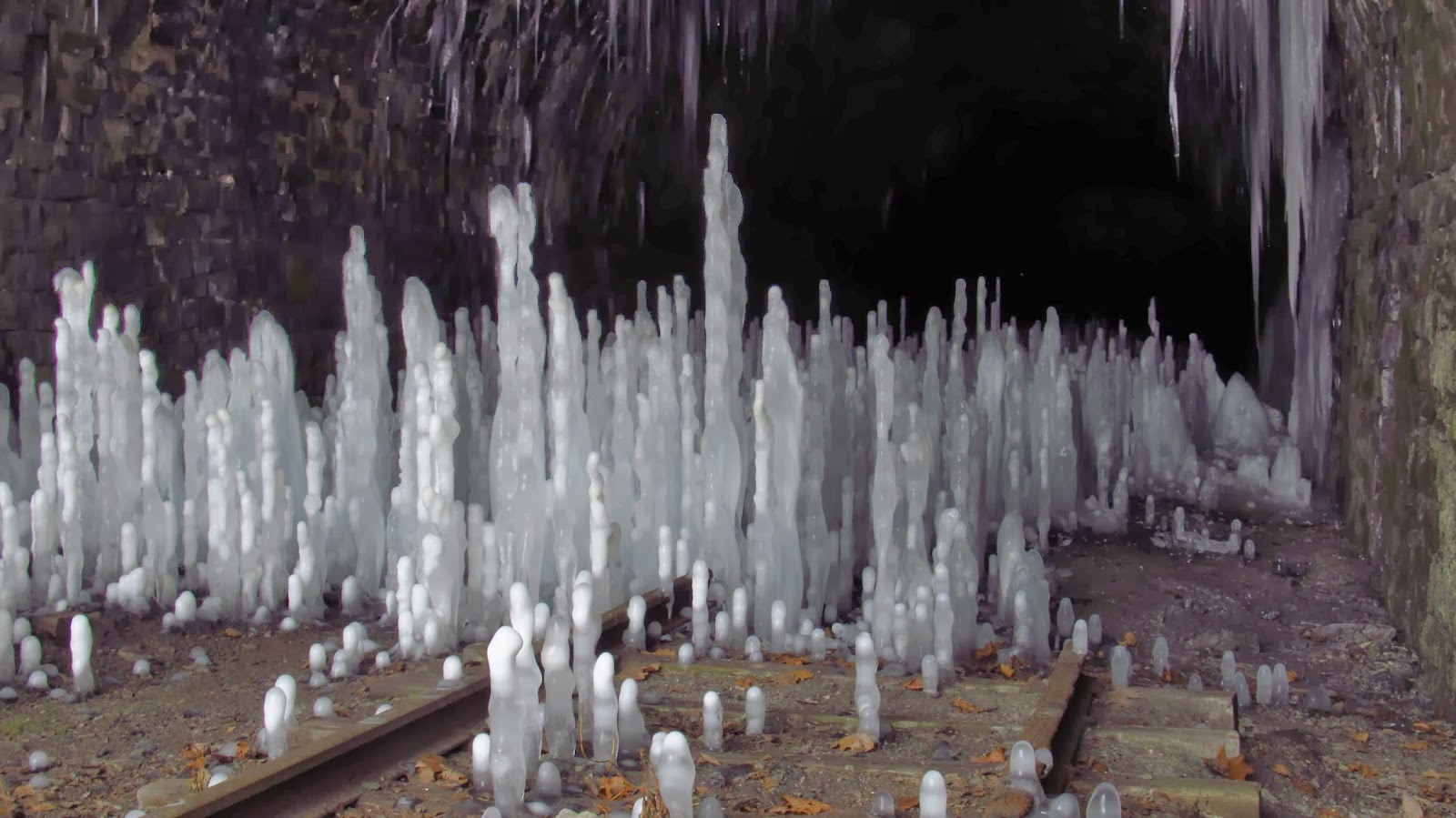 |
| Ice stalagmites at the Bow Ridge Tunnel (1907) on the dam side. |
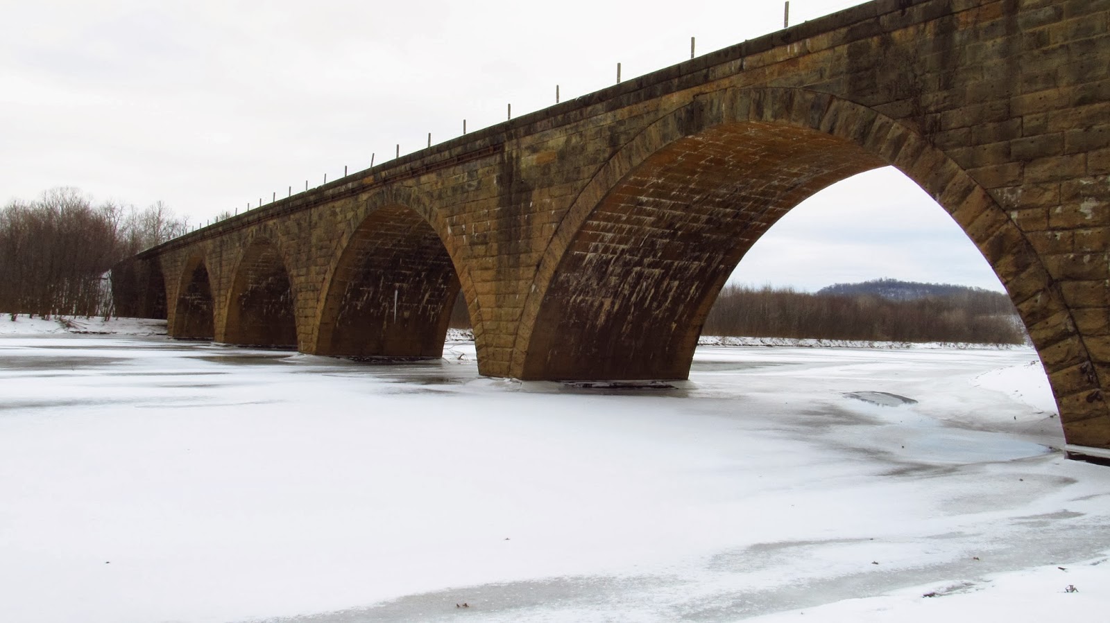 |
| Livermore Bridge and an iced over Conemaugh River. |
 |
| Huge icycle from a drainage hole under the tunnel. |
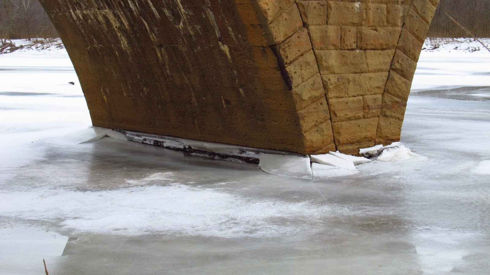 |
| Ice buildup on the bridge pier. |
Update 4/11/15
With the spring storms come great flooding. The Bow Bridge was completely underwater today.