The Delmont Gas Coal Company was officially formed January 1, 1914 with $200,000.00 capital stock and was headquartered in Greensburg. The directors (all from Greensburg) were: Ezra M. Gross, James H. Gallagher, and Thomas G. Taylor. Gallagher also served as treasurer. Thomas G. Taylor was a successful Greensburg attorney. He served as Assistant District Attorney in Westmoreland County and was promoted to Deputy Attorney General by Governor Fisher in 1927.
Delmont Gas Coal Company's No. 2 Mine began operations in 1915 and was worked until the 1930's. Eastern sections of the mine were strip mined later but a large portion of the mine appears to remain intact. The company operated at least 7 other mines in the area. Their No. 3 Mine was directly north of this mine and appears, from mine maps, to be interconnected.
This mine ran as far south as Legion Lane in Delmont and east just short of Twin Valley Cemetery. The western end bordered the New York & Cleveland Gas Coal Company's Delmont No. 1 Mine at White Valley. The northern border of the mine was the Turtle Creek Branch Of The Pennsylvania Railroad, where the tipple was located. The No. 3 Mine was north of the tracks.
The mine had two entrances. One was located south of present day Ringertown Road and the other was located north of the presently named Noca Court. Both entrances are still visible today. The man who owns the property that the Ringertown Road entry is located told me the present day road did not meet Rt. 66 until some time in the 1960's. Old maps verify this. He also told me his father worked the mine.
This is a detail of the area I made from the old mine map.

This is a closeup of the northern section.

And the southern section.

These are the photos I took today starting with the entry off Ringertown Road.
 |
I think one of the reasons this entry was left intact and the other was not is this one contains a USGS benchmark. I didn't look for it because this place is a swamp but it is noted on maps. I could also be wrong. Just a theory. |


Next we head to the tipple ruins.

These tipple piers really stand out now. The last time I was out here was in the summer and it was hard to see much.

This is looking from the railway toward Ringertown Road.


Here is where the siding of the railway would have been.


On the right is the main thruway of the rail line. The left is the siding.

This is looking toward Rt. 66 where the train tunnel would have been. I was told that when Rt. 66 was widened to four lanes the tunnel got buried. The other side where Industrial Drive is must have been filled in at one time. I followed the railway before and there would have had to been a downgrade to reach the tunnel. Right now that area is level with 66.

An old railroad tie in the siding section.

This is the only railroad tie I found in the whole area.

Looking toward the old railway.

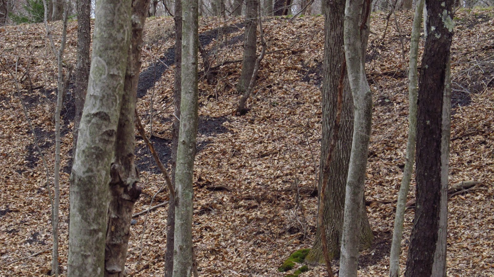
Some of the slate dump.

This is headed toward Ringertown on the railway. You can see where the grade for the siding comes to an end on the left.

Rt. 66 in the background.

Looking toward the railway.
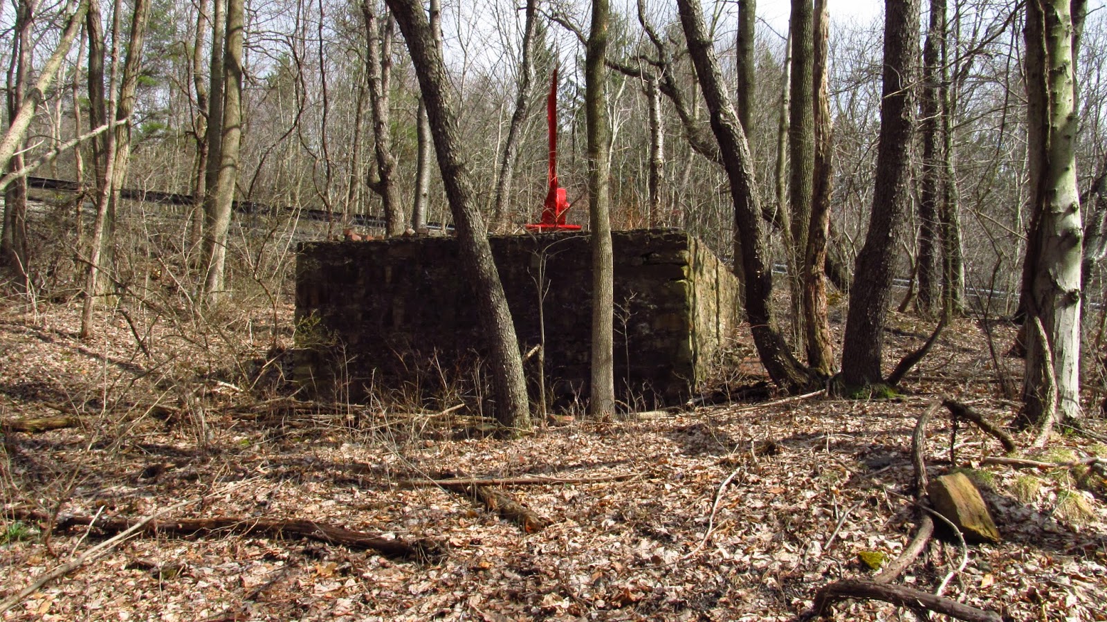
This is the foundation for the engine house. The red steel object is a memorial to miners of the 1910 and 1922 mine strikes.

The well that is listed on the map.
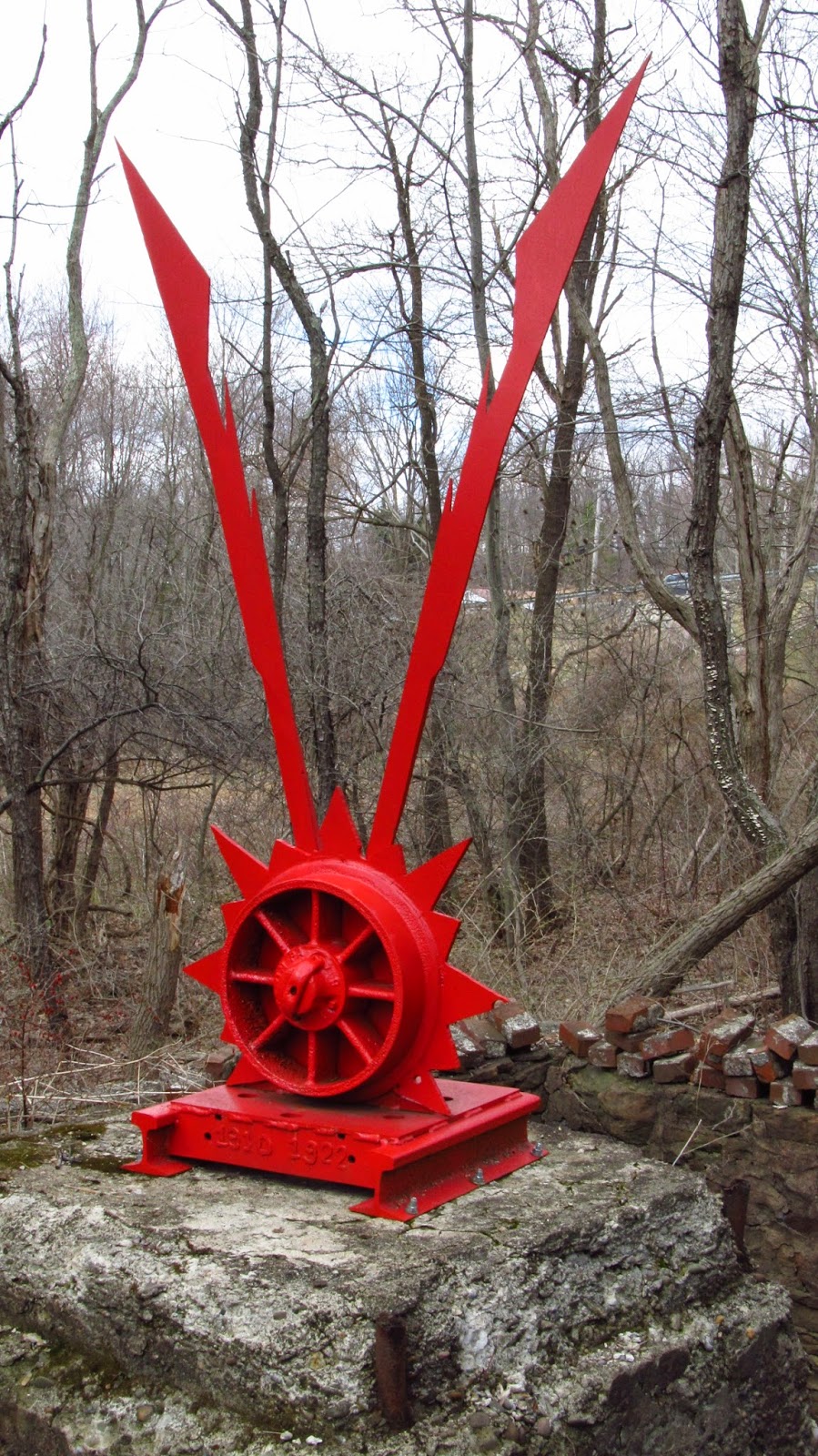
The striking miners' memorial.


More photos of the northern end slate dump.

Slate dump closeups.


These tipple piers really stand out now. The last time I was out here was in the summer and it was hard to see much.

This is looking from the railway toward Ringertown Road.


Here is where the siding of the railway would have been.


On the right is the main thruway of the rail line. The left is the siding.

This is looking toward Rt. 66 where the train tunnel would have been. I was told that when Rt. 66 was widened to four lanes the tunnel got buried. The other side where Industrial Drive is must have been filled in at one time. I followed the railway before and there would have had to been a downgrade to reach the tunnel. Right now that area is level with 66.

An old railroad tie in the siding section.

This is the only railroad tie I found in the whole area.

Looking toward the old railway.

Some of the slate dump.

This is headed toward Ringertown on the railway. You can see where the grade for the siding comes to an end on the left.

Rt. 66 in the background.

Looking toward the railway.

This is the foundation for the engine house. The red steel object is a memorial to miners of the 1910 and 1922 mine strikes.

The well that is listed on the map.

The striking miners' memorial.


More photos of the northern end slate dump.


Slate dump closeups.

The following is the entry off Noca Court. This one was a little trickier to locate but once I did it's pretty unmistakable.
 |
| I walked past that a few times until I decided to look inside. |


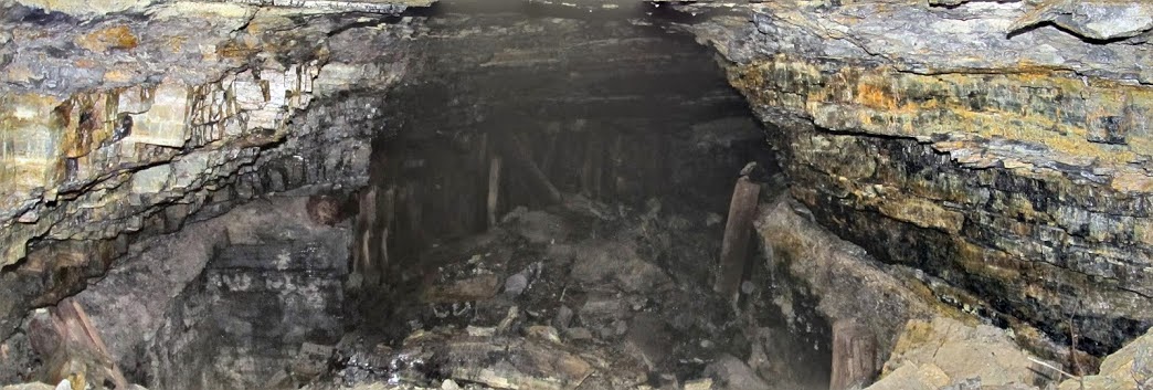
Let's look inside!!
 |
| I wasn't about to crawl through the hole so I just put my camera down there with the flash on and started snapping. |
 |
| I think they turned out pretty cool. |
 |
| It's hard to tell how far you could get if you went into this thing. I ain't trying. |


 |
| This is the slate dump on the lower end. |

Here's an old photo of a locomotive used in this mine.
 | |
| photo courtesy of http://patheoldminer.rootsweb.ancestry.com/county.html |
If you would like to see other old photos of Delmont, check out the book Salem Township and Delmont by my friend Tracy Searight here: http://www.amazon.com/Township-Delmont-America-Arcadia-Publishing/dp/0738592994#
And here is a nice song and pictures about Delmont.
Come out to our annual history tour and check out our apple festival every October!!
Update 10/9/14
These are a couple cell phone photos of the area around the two mine entrances. We located some old mine track near the pit mouth by Noca Court and a little piece further by the main entrance.
 |
| This is located on the hillside near the Noca Court pit mouth. It looks like the track would have wrapped around the side of the hill toward the tipple area. |

 |
| This track was laying behind the above photos with the railroad tie wall. It was going in the direction of the Noca Court pit mouth. |
 |
| This curved piece of mine track stopper was laying a little closer to Ringertown Road. It didn't appear to be connected to any other track. I was able to pick it up. It looks like it was just left there. |

The following photos are from 2/14/16. These mine ruins really stand out great accented against the snow.


