Sunday, August 27, 2017

New Laurel Furnace

Today seemed like a great day for some preseason site locating. I wasn't expecting much because everything is still overgrown. That really didn't matter much in this case. I was able to locate the New Laurel Furnace along an extremely rough road, in state game lands, in a very isolated section of Dunbar Township. The only real vegetation were mountain ferns and trees, so everything was pretty clear at the site. The day was cool enough to keep the snakes at bay too. 


Located along Morgan Run, the New Laurel Furnace was constructed, (according to the Second Geological Survey) in 1827 or 1828 by James Paull and Sons. In 1834 it was sold to David Kaine, who ran it until 1838. The furnace is roughly 190 years old. The New Laurel Furnace is located about 1 1/4 miles downstream (Morgan Run) from the "Old" Laurel Furnace. The original Laurel Furnace was constructed in 1794 or 1797, depending on the resource, by Joshua Gibson and Samuel Paxson. It was later sold to Reuben Mochabee and Samuel Wurtz, operators of the Hampton Forge (ca. 1800), located along the Indian Creek, a half mile from the Youghiogheny River. The original furnace was blown out in 1812 and its stone was used to build the New Laurel Furnace. That makes the furnace stone itself around 220 years old. The Hampton Forge lasted until 1825. 


This is one of the nicer furnace sites I've found. Three sides of the furnace are intact, as well as what I am assuming was part of the structure that held the water wheel. Stones are still intact along the mill race and this site is a slag collectors dream. 


Located right off the road. This is New Laurel Furnace today.


Still very much intact, but it's starting to show its age.


To the right of the furnace is the structure I believe may have been part of the water wheel. The race is between the furnace and this structure. It still contains water and sections of the water are red from iron.


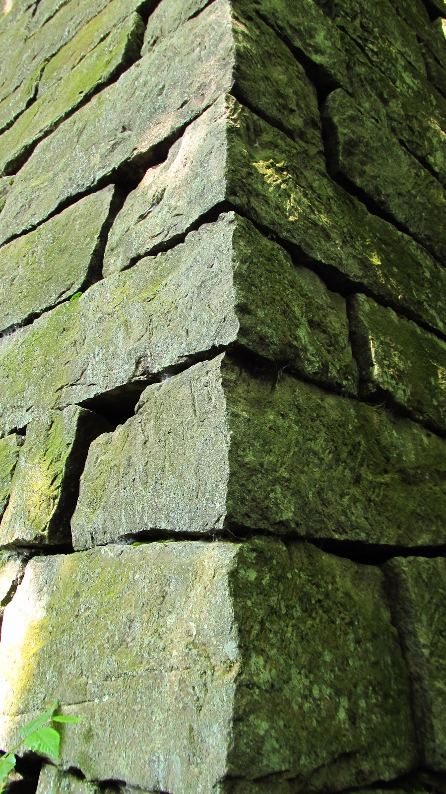
This corner is still incredibly intact.


The structure I believe once held the water wheel. This is side facing the furnace.


The tuyere arch where the bellows would have blown air into the furnace. This arch is approximately 8 feet wide at the bottom and 12 feet high.


The bottom inside of the arch.


Looking at the wheel pit from the arch.


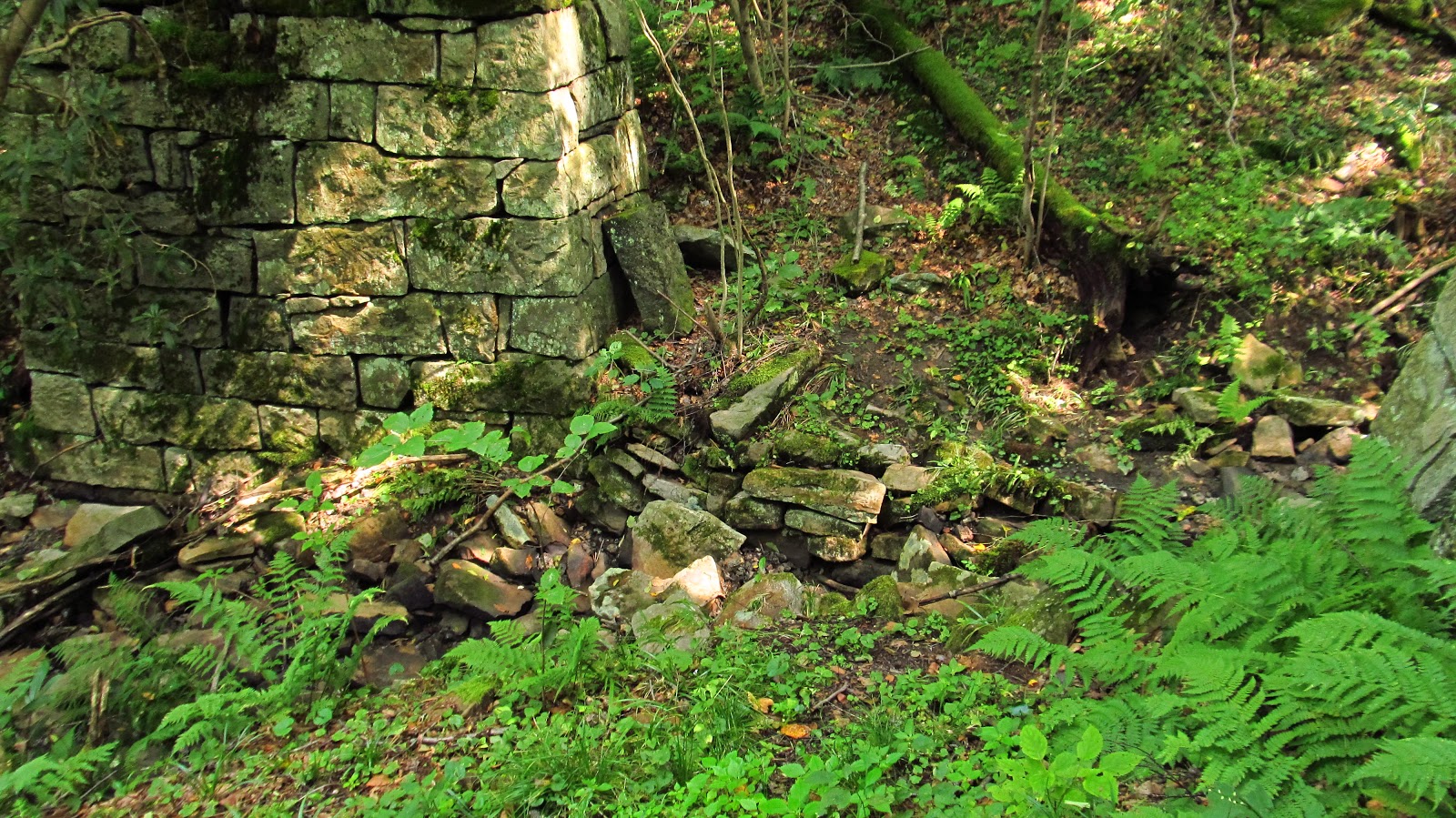
You can see the intact stone along the race.


Huge pieces of cut stone that have fallen down from the furnace.


This would have been the side where the furnace was tapped and where the iron flowed. Only one side of the arch remains.


You can partially see a section of the stack that is hidden behind the debris. I wasn't climbing these rocks. Mountains and large rocks = rattlesnakes.


You can see a little bit more of the stack here.


Trees growing out of the side of the furnace. Nature is slowly reclaiming these.


Notice the stone to the right slowly pulling away.


The top of the intact arch.


The back side of the possible wheel structure. Notice how the stone is perfectly shaped.


Furnace slag everywhere! Nice and shiny.


Another view of the corner.


Huge cut stone always makes me drool. I doubt that will ever change.


The ground at this corner has eroded enough that the footers this whole massive structure rests on are exposed.


A couple closing views. What an incredible furnace.


Such incredible stonework.


After leaving the furnace, I drove down the road along Morgans Run and came across this waterfall. After asking around a little bit it turns out its name is Blue Hole. You can jump off the cliff into the hole or slide down the falls. I didn't do either.


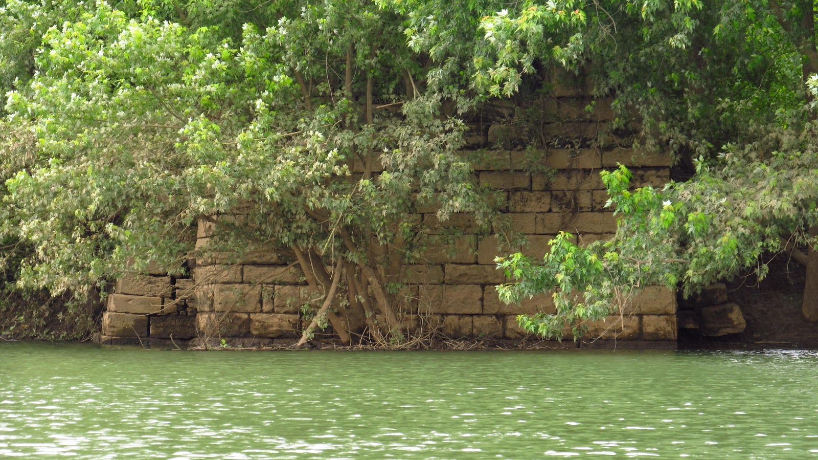
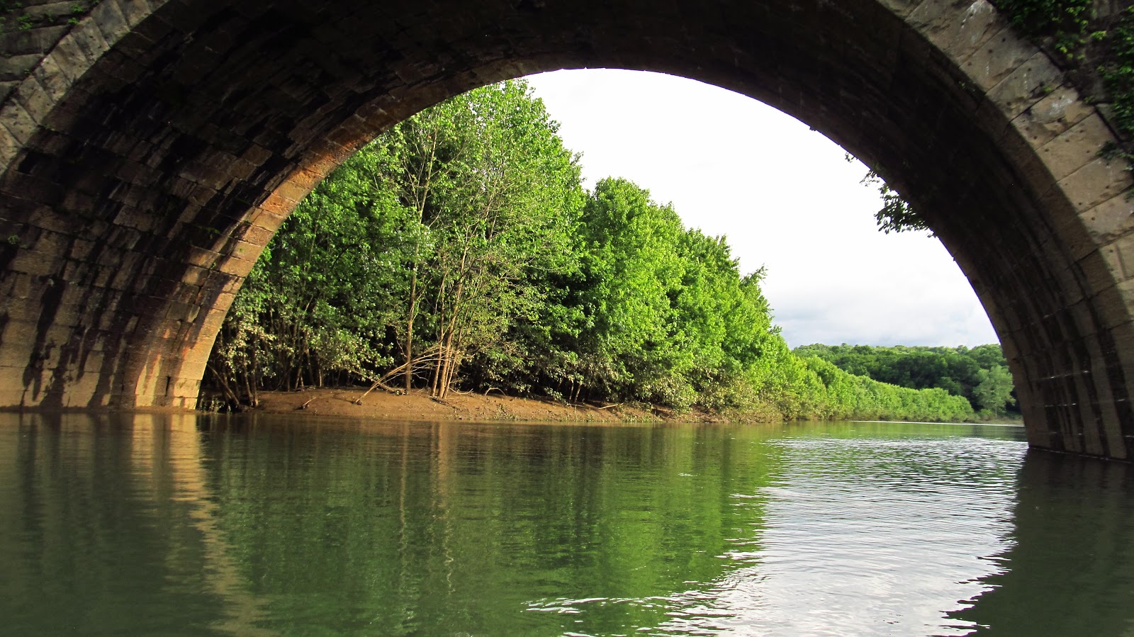
A little further down, Morgans Run passes under the Great Allegheny Passage before emptying into the Youghiogheny River.


Thursday, June 8, 2017

Stone Arch Bridges on Conemaugh River Lake

Today I took to the water to explore some areas that are inaccessible by foot. I've done about everything I could with these bridges on foot and by bicycle. I've always wanted to get under the bridges, explore abutments from the old 1854 bridge, and look through the flooded areas of Livermore and Filmore. It was great! Aside from the bridges I saw a bald eagle, great blue heron, hawk and osprey. This place doesn't look very large on a map, but it took me seven hours to paddle this whole section.


This is the section I explored today. I marked the area where I put in at as well as the flood lakes I named today. From where I started, I headed west toward the dam. I went to those two bridges as well as abutments from the original 1854 railroad alignment. After that I headed back and picked up again at Livermore.


Headed to the first stone arch bridge of the day. This is the second bridge heading east from Bow Ridge and the old railroad tunnel.


This is one of the abutments for the 1854 alignment. I have wanted to get to this for years. It is possible to reach it from Livermore following the old rail grade, but getting to the grade itself is something I've never been able to do. It's extremely muddy in winter and very wet in summer. The terrain in Livermore is very difficult to figure out too.


You can see the old rail grade heading back from the abutment.


I am a sucker for cut stone. It absolutely amazes me. This stone was laid 163 years ago and it is still perfect.


After countless floods, thaws and freezes, this stonework has remained completely intact. The old masons were unbelievable.


 Mason Marks and Stonework:


When the stone masons cut stone, they would leave their mark in the stone to get credit for their work.


I have been reading these mason marks for a few years and this is the first time I've ever seen a mark that looks like a Knight's Templar symbol.


A more common type of mason mark. Look for these next time you see old stonework. They are very common on old bridge piers and abutments.


The stone toward the back of the abutment is more rough cut.


It's unique in the way it's fitted. Notice the drill marks from when the stone was being cut.


Thick, heavy vines haven't damaged the stonework either. There is no mortar in these old abutments. All this stone is cut and fitted.


More of the railroad grade leading from the abutment. The original alignment ran through Livermore after crossing this bridge and avoiding the curve in the river to the north. After reaching Livermore it followed the west bank of the river around the curve, it then headed away from the river, crossing it once again at Social Hall (just north of where the current railroad alignment crosses Westinghouse Road). In 1907 the stone arch bridges were built to eliminate all the curves and give a more direct route.


Detail from the 1900 Latrobe quad topographic map.


Another view of the old railroad grade.


The 1854 abutment in the foreground, and it's replacement, the 1907 bridge in the background.


Again, notice the differences in the rough cut stone toward the back and the dressed stone at the front. I believe the rear of this abutment was buried prior to the flood control project. The water washed the fill away. It explains the difference in craftsmanship. The abutment on the other side of the river supports this theory.


Notice the drill marks from when this stone was cut. This abutment is a truly unique example of how these were constructed. Obviously, great pride was taken by the stone masons. All visible stone was dressed. This back stone were probably pieces that were broken or didn't cut properly.


A more common example of a mason mark. No, I didn't carve it.


I have seen this mark in other places in the Conemaugh Valley.


The other side of the abutment. Same situation with the stonework.


Heading across the river to the other abutment. I have reached this before by land but have never seen the front before.


A really unusual mason mark.


The front of the abutment.


Remember what I said about the other abutment being buried at one time? This definitely supports that theory.


Back to the 1907 stone arch bridge. This is the second bridge heading from the Bow Ridge tunnel, or the West Penn Trail switchback.


Between this bridge and the Bow Bridge the river is lined with steep cliffs. Prior to the flood control these banks were probably a lot higher from the river. The water starts getting really deep here. This is also the area where I saw the bald eagle. He was much quicker than me.


This is as close as I got to this bridge. The water was up to the top of the arches and there is always a field of debris before the bridge. This area is extremely deep and I wasn't taking any chances.


A bridge for the current railroad alignment.


Heading back toward Livermore.


This is the section on the map I named Livermore Bay.


Livermore Bay on the right, Conemaugh River on the left.


Approaching Livermore bridge.


This is part of the abutment for the bridge that connected Livermore and Filmore.


This old postcard I have shows the bridge. I believe it was taken from the Filmore side due to the houses behind the bridge on the right side. From the maps I've seen, most of Livermore was south of the bridge.


Back to the Filmore side of the bridge.


This would have been the main street in Filmore.


A photo of Filmore. I don't remember where I got this, it was on my computer. It might have been from Blairsville Historical Society.


Old lumber from the bridge abutment.


Livermore bridge. We're getting there....


Downtown Filmore. I really needed a bathroom break after being on the kayak for hours. I decided to stop here and jumped right into the ankle deep mud.


Just liked Livermore, there is no visual evidence of there ever being a town here. Any foundations that may have remained have been long buried in mud. Any concrete streets or sidewalks are also long buried.


Looking across from the Livermore side.


Before the Livermore Bridge is the Gulf of Filmore. This is another view of the site of Filmore.


Heading out into the gulf.

This is the osprey I saw.


At the far end of the gulf I found the far left section of the Livermore bridge. It was flooded just enough to paddle through it.


A number "8" I found carved into one of the arch stones.


On the other side of the arch I found what could be a "7". It looks more like somebody was playing hangman with a chisel.

The gulf.

Livermore bridge! I told you we'd get there!


Between Livermore bridge and the last bridge was this little cove with a small waterfall.

The final bridge!


This big helicopter flew over.


Notice how much more shallow the water is up at this end. The arches are almost completely exposed.


Notice the water behind the arch. I ended up going back there and what I found was amazing.


Heading back under the arch.

It led straight into an old section of canal. I was able to get around this obstacle and got to paddle on the canal for about 100 yards.


Looking back out the canal. The arch was actually built in the center of it.

Arch built in the canal bed.

Final looks at the bridge. Time to go get something to eat.


10/14/2017


A very unseasonably warm day. I hit the water again. The water was a lot lower than it was in June. I went up into "Livermore Bay" and located a nice cut stone culvert in the original 1864 railroad grade.


The culvert under the original railroad grade. This would have been underwater earlier in the summer.


More photos of the original 1864 West Penn Railroad grade.


10/21/2017


Another insanely nice day. Another trip out to Livermore. Today, with the water incredibly low, I went out to look at the old piers that were underwater over the summer. They didn't disappoint . There are still iron rods sticking out of the top that the bridge would have been attached to. The only potential mason mark I could see is probably just somebody's carved initials. We'll get into that in a little bit. I did locate additional mason marks on the west abutment that were underwater before. The east abutment was on dry land today. I also looked again at the old Filmore side abutment for the road bridge between there and Livermore.


The stone is still incredible. Especially after being underwater most of the time.


Remnants of the iron rods that held the bridge together.


The western pier with the western abutment in the background.


This is the only potential mason mark visible on the piers. I have my doubts. The water throughout this section of river averaged around two feet. That's not a scientific measurement. That's just an estimate from putting my paddle in and touching bottom. However, around these piers it was well over paddle deep. Maybe it was a swimming hole and people jumped off the piers in the summer. Somebody may have carved his initials. I kind of doubt this too because the quality of the water, up until the past decade or so, was nothing you'd want to swim in. I still don't think it's ideal for swimming. So these initials are a mystery for the ages.


The top of one of the piers. The second bridge from Bow Ridge in the background.


Eastern pier with the eastern abutment in the background. Remember in the summer when we paddled right up to the abutment and well up the grade? It's landlocked now.


Top of a pier. Bent iron.


Another one of those Knight's Templar looking mason marks. The lower one was underwater in June.


The field and trees in the background are where we paddled to the eastern abutment in June.


The Eastern Livermore/Filmore Bridge pier.


This was underwater in June.


A drain toward the bottom of the abutment. There was an old pipe inside but it didn't turn out in the photo.


Great Blue Herons!


Catching a fish.