This was a pretty difficult excursion. This was the original alignment of the West Penn Railroad and was used until 1885 when a new route was chosen on the other side of the Kiskiminetas River. Some of this is incredibly intact and some of it is extremely difficult. I took an elevation reading on the old bridge abutment in Saltsburg so I would be able to get started on the other side. The grade rose over 100 feet in a little over 2 miles. It's no wonder this alignment was abandoned. It contained an extremely difficult ravine where there had to have been a bridge at one time. A few sections were washed out over the years and a couple old roads made it a little confusing. Heading north was more difficult and I ended up being much lower than I needed to be. Once I found the massive Helena Cut and started making my way back toward Saltsburg it became a lot clearer. The northern section is much more intact.
If you plan on hiking this, don't. Just look at these photos and save yourself some grief. I know I'll sleep good tonight.
 |
| This is directly on the other side of the old bridge piers at Saltsburg. |
 |
| Already it gets confusing because this is an old road. It could have been built on the old rail grade though. |
 |
| An extremely cool old abandoned house. |

 |
| Old foundation near the old house. |

 |
| This is part of the rail grade. After this it starts to pull away from the river and begins heading upgrade. |
 |
| Rising up away from the river. |
 |
| Some old railroad ties. I doubt they are from here though. They don't look like they're 129 years old. |
 |
| This is where I started getting confused. The rail grade is to the left of this road. This is Heimberger Road. |
 |
| The bridge piers for the Mt. Gray Mine. The mine was located on the other side of 981 and shipped the coal across the river to the 1885 alignment of the railroad. |

 |
| Rail grade again. I saw two bald eagles here but my camera was in my backpack and I couldn't get to it fast enough. |


 |
| A couple of piers on land. This area had a ton of coal laying around from the Mt. Gray Mine. |


 |
| Coal everywhere. |
 |
| This is still rail grade. |
 |
| After this it gets confusing. I lost the rail grade for a while. |
 |
| But I did find this old foundation. |

 |
| This chipmunk, the two bald eagles and a few deer were the only signs of life I found back here. |


 |
| Back on track again. |
 |
| This is the massive Helena Cut. |
 |
| It's hard to capture but this is extremely deep. |
 |
| I don't know why they didn't tunnel through this. |

 |
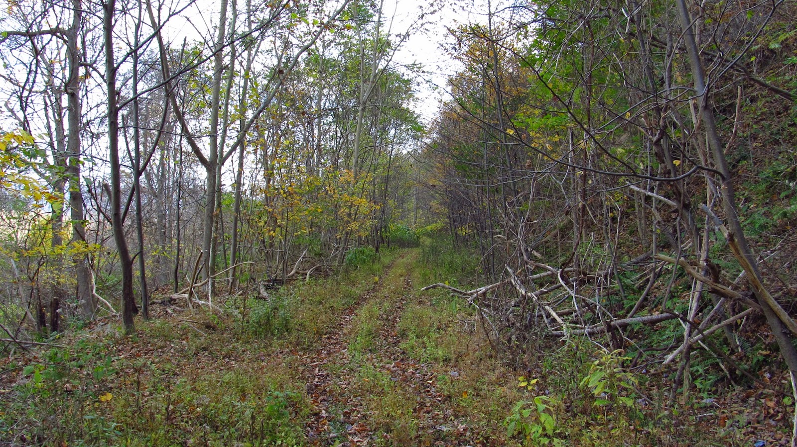
| Heading back toward Saltsburg. This is a really nice section. |
 |
| A lagoon off of the grade. |

 |
| Getting a little rougher. |
 |
| Into another cut. |
 |
| More grade. |

 |
| A Norfolk Southern across the river. |

 | |
| Heading south. |

 |
| Looking across a field to the river. |

 |
| After this it gets pretty sketchy. |

 |
| Heading toward the nasty ravine. |
 |
| The other side of the ravine. I had to get from here to there. |


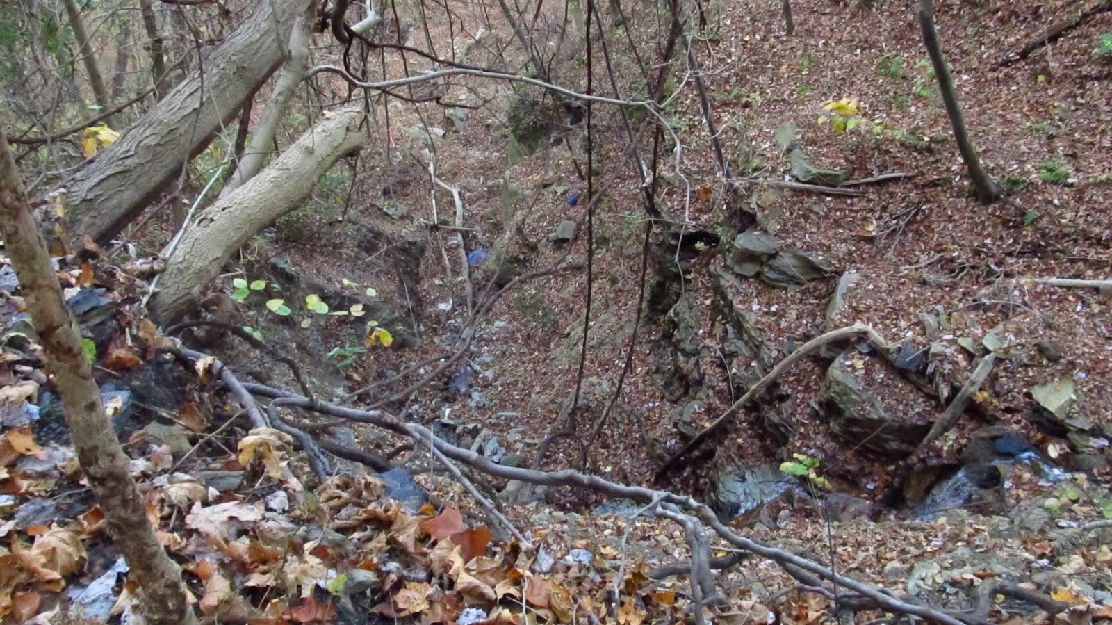 |
| Looking down into the ravine. There had to have been a bridge here at one time. Maybe some of those foundation stones came from the abutments. |

 |
| I went up and around and made it to the other side. |

 |
| This was another weird cut heading away. I'm thinking it might have been part of the Fairbanks Mine branch. |
 |
| This is the Fairbanks Branch grade. |
 |
| An old marker stone. |
 |
| After coming to another ravine and realizing I once again lost the main grade, I climbed down the hill, walked up a driveway to Harvat Road and walked back to Saltsburg. |
These are out of the 1876 Westmoreland County atlas showing the original 1854 alignment.

