Saturday, November 30, 2013

Derry No. 2 Coke Works/Red Shaft

I have been unable to find much information on the Red Shaft Mine and Coke Works. These coke ovens sit along Panizzi Road in Derry Township and are almost the entire length of the road. The ovens in the middle still have their fronts but the rest appear to missing them. They sit behind a cattle field and Union Run and also seem accessible from Pandora Road but there is an electric fence. I took a couple pictures from the road but hope to talk with the farmer at some point to see if I can get back there. 

The ovens sit along the old Bradenville Branch of the Pennsylvania Railroad heading up to Superior. This rail line dates back to circa 1901.  This branch does not appear on the 1900 map. Comparing Red Shaft Coke Works to the other coke works in the area could possibly date them to around 1901-1903. 

Anybody with any information on Red Shaft or if you know the property owner, please contact me. 


Saturday, November 23, 2013

Cokeville, PA / Isabella Furnace Mine and Coke Works

Cokeville, like Livermore and Filmore, was a victim of the Conemaugh River flood control project in the 1950's. Following the St. Patrick's Day flood of 1936 the Army Corp Of Engineers began planning a dam project on the Conemaugh River to harness the flood waters. There were 122 structures in Cokeville on a 1951 map. In 1952, as the town was being evacuated for the flood control project most of these structures were razed but some were moved up the hill to Cokeville Heights near Rt. 217.

The town traces its roots back to 1858 when it was known as Broad Fording, due to it's easy crossing on the Conemaugh River. Cokeville was served by the Pennsylvania Mainline Canal until the Pennsylvania Railroad located it's tracks along the canals towpath around 1864. The name was changed in the early 1870's to Coketown, Coketon and finally Cokeville after The Isabella Furnace Coke Company erected a 200 oven coke plant on the hillside above the town. The town was incorporated in 1887. 

The coke produced here was shipped to the Isabella Blast Furnace in Etna, PA on the Allegheny River. The H.C. Frick Coke Company took over the operation around 1901 and the ovens went out permanently in 1903. 

The only things remaining here today are the bridge abutments of the road bridge from Blairsville as well as the railroad bridge abutments a little further up the river. There are still concrete roads on the two sides of the town and a few fragments of the side streets. The only remains of the coke plant I could locate were some impressions in the ground, a single crown brick from a beehive oven and a couple pieces of coke. I think whenever Torrance Road went in it took out a lot of the coke bank but I could be wrong. The ovens could simply be buried after 110 years.

This is the road leading down into Cokeville.

This abandoned bridge is the first crossing into the old town.
One of the bridge sides.

This is looking off the bridge at an old retaining wall for one of the rail lines going in or out of the town from the coke plant.


The railroad bridge.


This is the road leading down to the river.


Old concrete road.
 

These are the bridge abutments linking Blairsville to Cokeville.

Looking over to the Blairsville side.
Someone hung a ladder on this one. It's probably a nice summer swimming hole.


This is the concrete road heading up from the other side of town towards the area where the coke ovens should be.
This is where the coke ovens should be. It looks like a bank, has impressions in the ground and the only thing missing is the ovens.

This is the single brick I found with the two small pieces of coke.

Some stone laying in one of the impressions in the ground.

Heading back towards the river to check out the railroad bridge abutments.

A couple interesting trees.


These are the railroad bridge abutments.

This is looking over to the Blairsville side at an orange waterfall from ferric hydroxide mine drainage.

Looking down at the railroad abutments. The water in the Conemaugh is green because of ferrous sulfate leaking from the many abandoned coal mines along the river. The Conemaugh is one of the most polluted rivers east of the Mississippi due to it draining one of the most extensively mined coal fields in the world.

This looks like it could be an old railroad mileage marker or a "W" signal marker telling the train engineer to blow it's whistle before entering Blairsville.

This is looking over at Cokeville from Blairsville.

The end of the road in Blairsville.

The river wasn't very high this day so you could walk right up to one of the abutments.


Water level chart.

A closeup of the stone work on the abutments.


Some old hardware on the side of the abutment.

Looking over at Cokeville.

  Return to Cokeville. 11/30/13

I went back out to Cokeville to try again to track down these coke ovens. I followed the old rail line and traced it across Torrance Road and pretty much ended up in the same area I was before. This time I looked a little harder and all I came up with was one almost completely buried oven, a few more bricks, and a lot more coke. This oven is the last remaining oven back there that I can find. It's a true testament that 110 years is more than enough time to remove visible traces of coke ovens. They are pretty far up from the river and I'm not sure how flooded this area gets but that might have played a factor too.

This was at the start. By the railroad bridge at McGee Run.

And this is it as far as physical evidence of coke ovens.


This is the bank where the oven I found was part of. The rail line is hardly level and difficult to navigate too.

Another piece of crown brick.

Another burned up brick.

The brick in front of the almost completely buried coke oven.

A small piece of railroad tie.


Sunday, November 10, 2013

Turtle Creek Branch of The Pennsylvania Railroad- Ringertown to Slickville.

This section of the Turtle Creek branch was built between 1915 and 1917. This line supported the expansion of the coal fields through the two patch towns of Ringertown and Dunningtown, crossed under Rt. 66 through a now gone tunnel, traveled north of Delmont and branched off to support the mines at Trees Mills.  The main line continued over a land dam through Beaver Run, serviced the Edwards Mines and continued onto the mines at Slickville. Eventually this section continued to Saltsburg, servicing numerous mines, before joining the West Penn Railroad.

This rail line also offered passenger service to the rural coal towns located along it's path. In 1936, due to lack of business, the passenger service was discontinued. At it's height, five passenger trains ran the line daily and on Saturdays passenger service was offered to Pittsburgh. The Saturday Pittsburgh trips became so popular that an average of 1,000 tickets were sold each weekend.

In 1972, The Pennsylvania Railroad filed for abandonment on the entire line east of Export.

Today the Westmoreland Heritage Trail runs from the point north of Delmont, at Athena Drive to Saltsburg. Eventually, the plan is to develop the entire line into a rail-trail linking Saltsburg with Trafford. 

In July I walked/biked the section between Trafford and Murrysville. Photos are available on this blog in the July 2013 index.

Above Ringertown.
This is the bridge between Ringertown and Dunningtown over Morosini Farm Court.

Pennsylvania Railroad stamps on this railing support on the bridge.

Leaving Dunningtown headed back towards the Delmont Gas No. 2 Mine. There are two posts about this mine in the January, 2013 index of this blog.
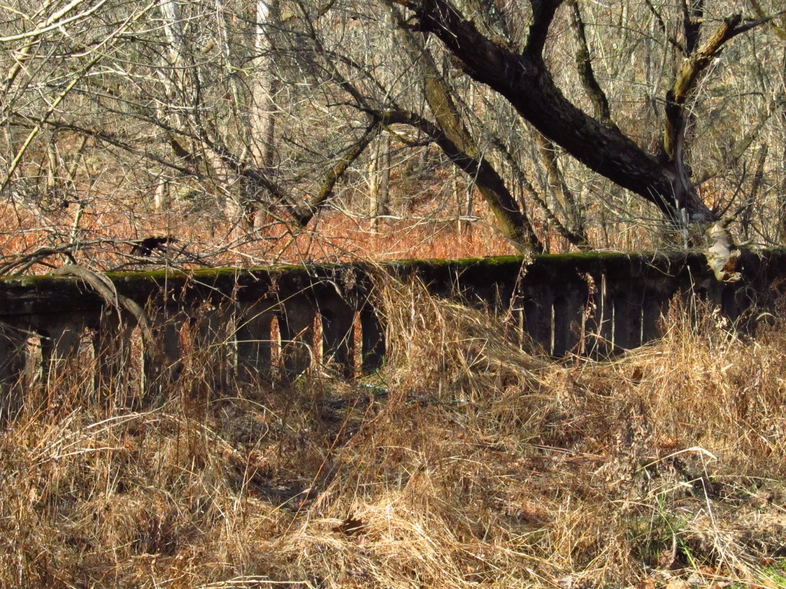
This is where it gets difficult. Rt. 66 is in the background. A tunnel was here at one time but has since been removed or filled in. Regardless, it's gone. I went through on another trail to Ringertown Road and crossed Rt. 66. I believe Industrial Drive in the Industrial Park on the other side of Rt. 66 was part of the old rail line. I took that through the park and into the woods again.

This is the ruins of an old stone house. According to the 1876 map of Salem Township this house is listed as the N. King residence. When I was a kid I used to come back here and the house was still pretty much intact. It was known around Delmont as Old Man Kings house.


This is the last intact window frame in the house. The back of it shows signs of fire damage. It could have been a fire that led to the houses abandonment.

One of the four remaining corners of the house.

The old chimney.

Looking out the window toward the abandoned rail line. Notice the burnt wood of the window frame.


The wood that wasn't burned suffered from severe termite damage.


Singed bricks and stone of the chimney.


A view from the northwestern corner of the house. Notice the rail grade in the background.


The eastern wall of the house.

It's amazing how tight the corners of the stone are still to this day.


This is a spring adjoining the house.


Some of the wood from the second floor beams remains.

This is the top of the window frame.
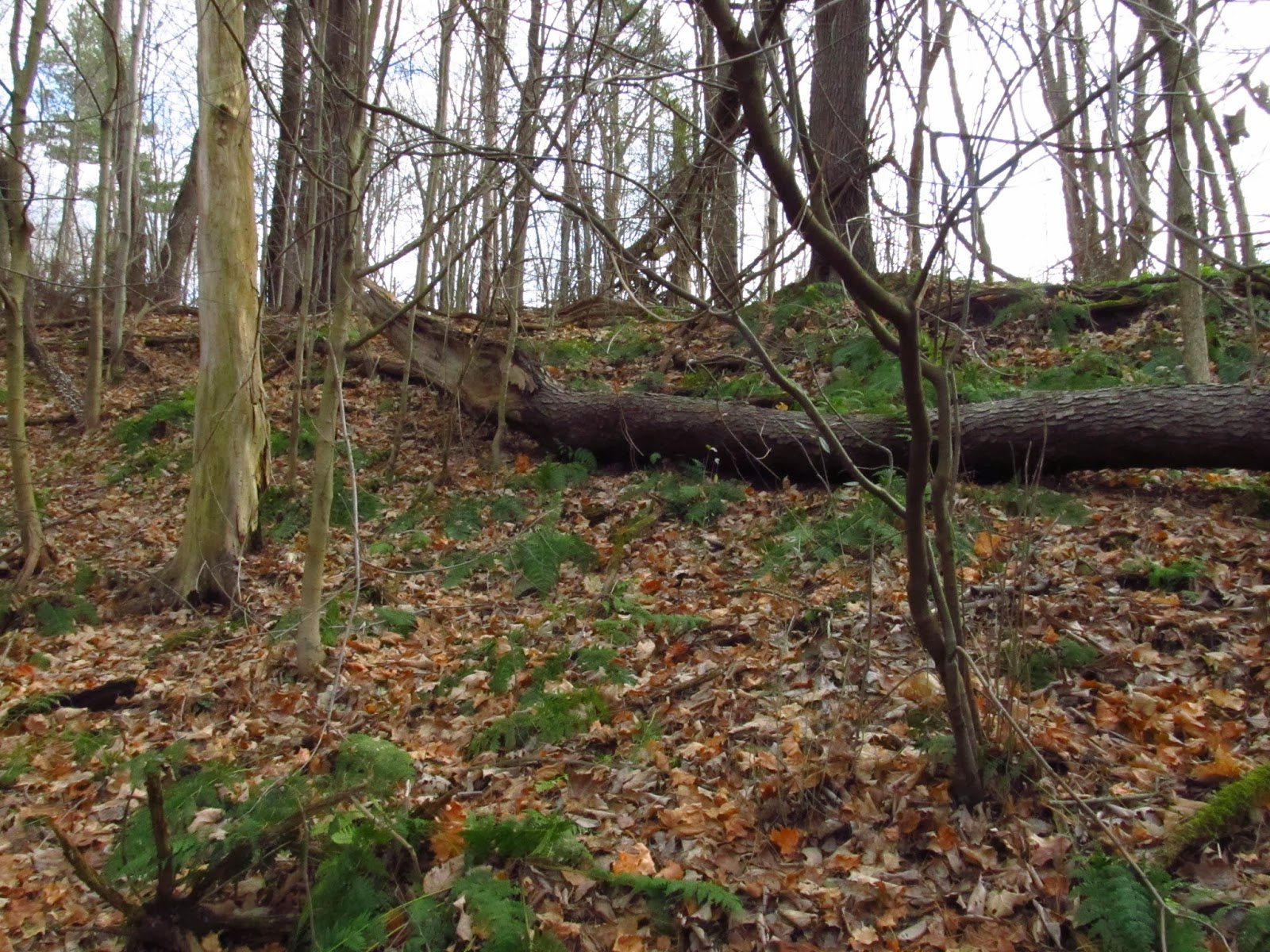
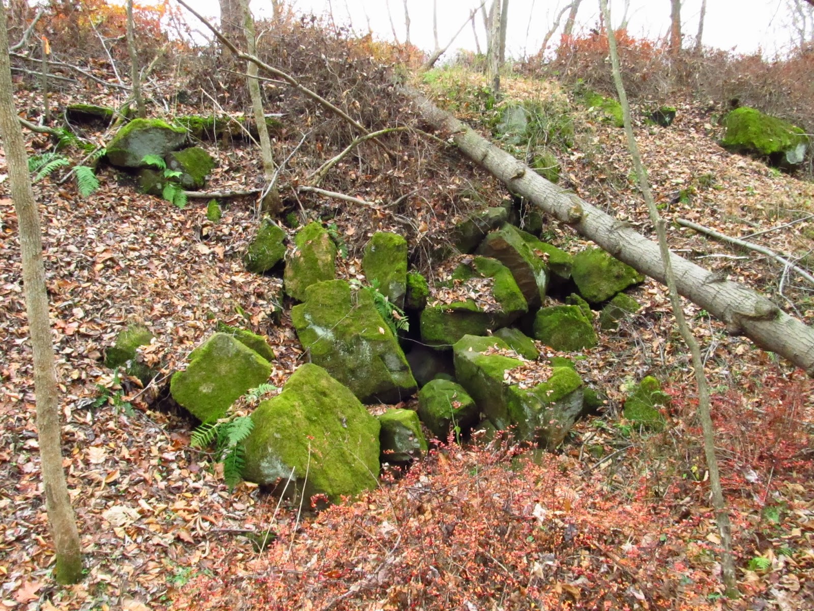
After leaving the old King house you come across this old stone wall. Possible barn foundation.
The rail line gets a little rough after this. There's still plenty of old railroad ties.
It got hard to follow at times. The slight cut and occasional railroad tie kept me going in the right direction.
This just got too grown in. From here the rail line would have passed over Athena Drive on an old bridge that is now gone. Also near this area was a branch that went up to the old Lauffer Mine. The grade can still be followed along Lauffer Mine Road. At this point I had to climb down a steep hill and get on the current rail-trail.
This is the branch that went to the Trees Mills mines. There was also a passenger station located on the other side of Beaver Run near Trees Mills Road.

The old Trees Mills branch grade.

This seems like an old sealed mine before the bridge crossing Beaver Run. According to old maps there was a mine in this area but it isn't named on the maps.


The old bridge footers in Beaver Run.


This is where the bridge would have passed over Beaver Run.

These are a couple pictures inside the sealed up mine.


Geese swimming in Beaver Run.

This is looking off the bridge after Beaver Run at the old Bailey Road. This section is now on water company property and is no longer a public road. There is a portion of the road still open off of Athena Drive.

Old tipple bases of the old Edwards No. 3 Mine. The signs around here are pretty straight forward about trespassing on water company property so I couldn't explore above it.

Coming in to Slickville you come across the old company store.

You know you're in Slickville when....  Hollywood style sign on the slate dump.

This is the area covered from the 1941 county map. The yellow is the main line of the Turtle Creek branch. The red is the approximate location of the Trees Mills spur and the blue is the Lauffer Mine spur.


This is the N. King house marked on the 1876 Salem Township map.


Cliff Jobe's- Slickville Blues


A nice write up from the Delmont Salem News about the old railway. 9/16/2015