Cokeville, like Livermore and Filmore, was a victim of the Conemaugh River flood control project in the 1950's. Following the St. Patrick's Day flood of 1936 the Army Corp Of Engineers began planning a dam project on the Conemaugh River to harness the flood waters. There were 122 structures in Cokeville on a 1951 map. In 1952, as the town was being evacuated for the flood control project most of these structures were razed but some were moved up the hill to Cokeville Heights near Rt. 217.
The town traces its roots back to 1858 when it was known as Broad Fording, due to it's easy crossing on the Conemaugh River. Cokeville was served by the Pennsylvania Mainline Canal until the Pennsylvania Railroad located it's tracks along the canals towpath around 1864. The name was changed in the early 1870's to Coketown, Coketon and finally Cokeville after The Isabella Furnace Coke Company erected a 200 oven coke plant on the hillside above the town. The town was incorporated in 1887.
The coke produced here was shipped to the Isabella Blast Furnace in Etna, PA on the Allegheny River. The H.C. Frick Coke Company took over the operation around 1901 and the ovens went out permanently in 1903.
The only things remaining here today are the bridge abutments of the road bridge from Blairsville as well as the railroad bridge abutments a little further up the river. There are still concrete roads on the two sides of the town and a few fragments of the side streets. The only remains of the coke plant I could locate were some impressions in the ground, a single crown brick from a beehive oven and a couple pieces of coke. I think whenever Torrance Road went in it took out a lot of the coke bank but I could be wrong. The ovens could simply be buried after 110 years.
 |
| This is the road leading down into Cokeville. |
 |
| This abandoned bridge is the first crossing into the old town. |
 |
| One of the bridge sides. |
 |
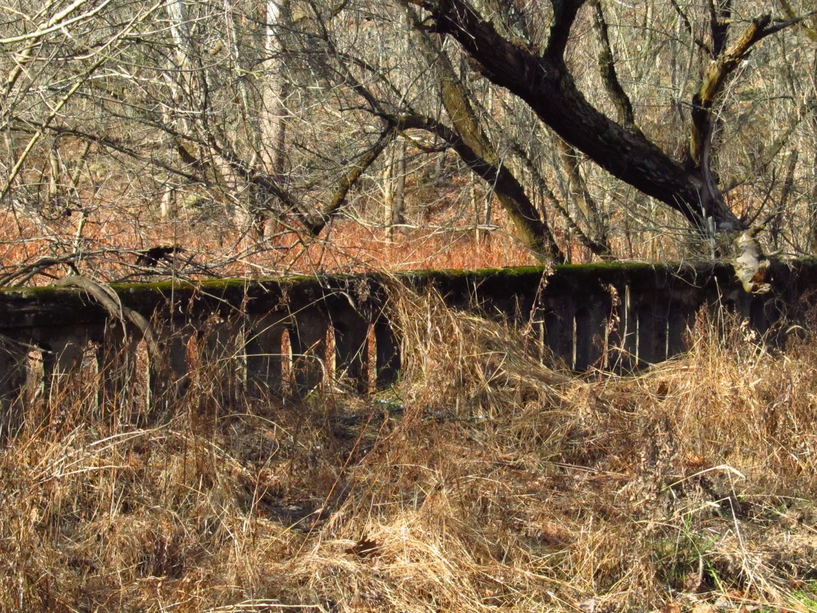
| This is looking off the bridge at an old retaining wall for one of the rail lines going in or out of the town from the coke plant. |

The railroad bridge.

This is the road leading down to the river.


Old concrete road.

The railroad bridge.

This is the road leading down to the river.


 |
| These are the bridge abutments linking Blairsville to Cokeville. |
 |
| Looking over to the Blairsville side. |
 |
| Someone hung a ladder on this one. It's probably a nice summer swimming hole. |

 |
| This is the concrete road heading up from the other side of town towards the area where the coke ovens should be. |
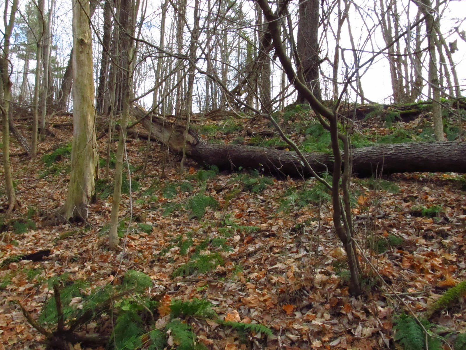 |
| This is where the coke ovens should be. It looks like a bank, has impressions in the ground and the only thing missing is the ovens. |
 |
| This is the single brick I found with the two small pieces of coke. |
 |
| Some stone laying in one of the impressions in the ground. |
 |
| Heading back towards the river to check out the railroad bridge abutments. |
 |
| A couple interesting trees. |

 |
| These are the railroad bridge abutments. |
 |
| This is looking over to the Blairsville side at an orange waterfall from ferric hydroxide mine drainage. |
 |
| Looking down at the railroad abutments. The water in the Conemaugh is green because of ferrous sulfate leaking from the many abandoned coal mines along the river. The Conemaugh is one of the most polluted rivers east of the Mississippi due to it draining one of the most extensively mined coal fields in the world. |
 |
| This looks like it could be an old railroad mileage marker or a "W" signal marker telling the train engineer to blow it's whistle before entering Blairsville. |
 |
| This is looking over at Cokeville from Blairsville. |
 |
| The end of the road in Blairsville. |
 |
| The river wasn't very high this day so you could walk right up to one of the abutments. |

 |
| Water level chart. |
 |
| A closeup of the stone work on the abutments. |

 |
| Some old hardware on the side of the abutment. |
 |
| Looking over at Cokeville. |
Return to Cokeville. 11/30/13
I went back out to Cokeville to try again to track down these coke ovens. I followed the old rail line and traced it across Torrance Road and pretty much ended up in the same area I was before. This time I looked a little harder and all I came up with was one almost completely buried oven, a few more bricks, and a lot more coke. This oven is the last remaining oven back there that I can find. It's a true testament that 110 years is more than enough time to remove visible traces of coke ovens. They are pretty far up from the river and I'm not sure how flooded this area gets but that might have played a factor too.
 |
| This was at the start. By the railroad bridge at McGee Run. |
 |
| And this is it as far as physical evidence of coke ovens. |

 |
| This is the bank where the oven I found was part of. The rail line is hardly level and difficult to navigate too. |
 |
| Another piece of crown brick. |
 |
| Another burned up brick. |
 |
| The brick in front of the almost completely buried coke oven. |
 |
| A small piece of railroad tie. |
Tremendous work, Mike! I love that stuff, too. There is something about poking around in old things people did, i can't quite put my finger on it..... Keep on!
ReplyDeletei live and hunt in the area of cokeville there are quite a few coke ovens remaining but there further up the river from where you were at there closer to the old rail road tressel. email me at monte952003@yahoo.com if your heading back out this way and i could show you around
ReplyDeleteReally? Very interesting. Thanks a lot. I'll definitely hit you up.
Deletetxt me when your gonna be around my name is Rich my cell is 724-422-1591
ReplyDeleteThanks Rich. I will.
DeleteHi Mike. Thanks for doing all this research and keeping the history of these areas alive. My mom and her family grew up in Cokeville; they were among the last families to leave in 1952. When I was a kid in the '60s we sometimes walked around in the abandoned town. It was spooky to me. The last "Cokeville Reunion" was held in 2011. All of the old folks who grew up there describe is a an idyllic community. Your photos are fascinating. It's really interesting to see the bridge remains. I grew up in Blairsville, and we could walk to the end of the road, beyond the ball field and the park (now called Wyotech Park; we used to call it Charley Park), and we could see the old bridge abutment. I will show your site to my mom. Thank you.
ReplyDeleteThank you Dana! I love hearing about the old town. It's interesting how the old roads are still there. I would love to see how it looked before. I've read about the Cokeville reunions and seen a few photos of the town. It's sad how they just closed down entire towns. Thanks for writing!
DeleteDana Spiardi, whose is your mom?
DeleteHi Joanne, if you want to send me your email address I can forward it to Dana for you. My email is oldjughead@yahoo.com.
DeleteHi Mike. I keep looking at your fabulous photo documentary of Cokeville, and I'm still amazed at the amount of time and research you put into this. I grew up in Blairsville (my dad's hometown), right across the river from Cokeville (my mom's hometown). You may be interested in knowing about an old factory that was located in south Blairsville on the banks of the Conemaugh. It was the Columbia Plate Glass Plant, and it operated in the early 1900s. Next to the plant was a small "company town" called "Tin Town." It was named for an old tin mill that operated there around 1901. My dad lived a few blocks north of Tin Town on South Liberty Street, and he talked about that area all his life. He played there until 1936 when the St. Patrick's Day flood wiped out most of the houses. And the plant had closed down, too. I only manged to find two articles about Tin Town on the Internet. The links are below. I also found an interesting hand-drawn map of the area, which shows where the plant and houses were located. If you'd like a copy I can email it to you. And if you want a picture of how Cokeville looked in the 1940s, I'll email you a nice photo of where my grandfather's store, gas station and tavern were located. It stood at the intersection where one road went to Torrance and one went to 217 (Blairsville). Thanks again for preserving this history. Here are the Tin Town links. Best regards.
ReplyDeletehttp://redtambourine.com/2009/02/24/tin-town/
http://www.alihanscuisine.com/menu.html
Hi Dana! Thank you! I would love to see a copy of the map and photo. If you could, on the left hand side of my blog under the "About Me" section is a contact form that goes directly to my email. If you send me your email address that would a good way to start. I don't think you can send attachments through this comment section. Thank you very much! I can't wait to see them!
DeleteMike
Will do, Mike! I'll be in touch soon.
ReplyDeleteHi. Just found this link. I was talking to an elder lady who grew up near here. I told her about my dad growing up in Cokeville. Before he died in 1994, he woke many memories of his life as a child in Cokeville. The Frick who owned the mines was a relative. I have some photos but mainly stories he told.
ReplyDeleteI am a Cameron. I know there are a lot of distant cousins floating around. It would be fun to communicate. My grandma was a McLaughlin.
ReplyDeleteWere you related to Pud Cameron?
DeleteI am a Cameron. I know there are a lot of distant cousins floating around. It would be fun to communicate. My grandma was a McLaughlin.
ReplyDeleteI am a Cameron. I know there are a lot of distant cousins floating around. It would be fun to communicate. My grandma was a McLaughlin.
ReplyDeleteHi. Just found this link. I was talking to an elder lady who grew up near here. I told her about my dad growing up in Cokeville. Before he died in 1994, he woke many memories of his life as a child in Cokeville. The Frick who owned the mines was a relative. I have some photos but mainly stories he told.
ReplyDelete