Today I took to the water to explore some areas that are inaccessible by foot. I've done about everything I could with these bridges on foot and by bicycle. I've always wanted to get under the bridges, explore abutments from the old 1854 bridge, and look through the flooded areas of Livermore and Filmore. It was great! Aside from the bridges I saw a bald eagle, great blue heron, hawk and osprey. This place doesn't look very large on a map, but it took me seven hours to paddle this whole section.
 |
This is the section I explored today. I marked the area where I put in at as well as the flood lakes I named today. From where I started, I headed west toward the dam. I went to those two bridges as well as abutments from the original 1854 railroad alignment. After that I headed back and picked up again at Livermore. |
 |
Headed to the first stone arch bridge of the day. This is the second bridge heading east from Bow Ridge and the old railroad tunnel. |


 |
This is one of the abutments for the 1854 alignment. I have wanted to get to this for years. It is possible to reach it from Livermore following the old rail grade, but getting to the grade itself is something I've never been able to do. It's extremely muddy in winter and very wet in summer. The terrain in Livermore is very difficult to figure out too. |
 |
You can see the old rail grade heading back from the abutment. |
 |
I am a sucker for cut stone. It absolutely amazes me. This stone was laid 163 years ago and it is still perfect. |
 |
After countless floods, thaws and freezes, this stonework has remained completely intact. The old masons were unbelievable. |

Mason Marks and Stonework:
 |
When the stone masons cut stone, they would leave their mark in the stone to get credit for their work. |
 |
I have been reading these mason marks for a few years and this is the first time I've ever seen a mark that looks like a Knight's Templar symbol. |
 |
A more common type of mason mark. Look for these next time you see old stonework. They are very common on old bridge piers and abutments. |
 |
The stone toward the back of the abutment is more rough cut. |
 |
It's unique in the way it's fitted. Notice the drill marks from when the stone was being cut. |
 |
Thick, heavy vines haven't damaged the stonework either. There is no mortar in these old abutments. All this stone is cut and fitted. |
 |
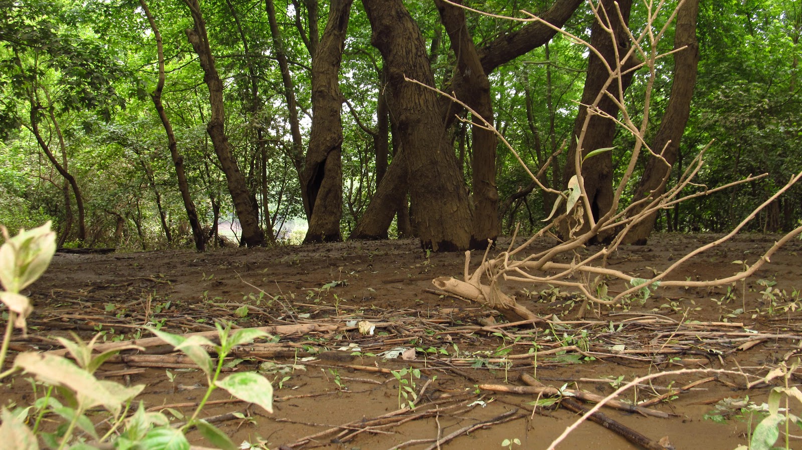
More of the railroad grade leading from the abutment. The original alignment ran through Livermore after crossing this bridge and avoiding the curve in the river to the north. After reaching Livermore it followed the west bank of the river around the curve, it then headed away from the river, crossing it once again at Social Hall (just north of where the current railroad alignment crosses Westinghouse Road). In 1907 the stone arch bridges were built to eliminate all the curves and give a more direct route. |
 |
Detail from the 1900 Latrobe quad topographic map. |
 |
Another view of the old railroad grade. |
 |
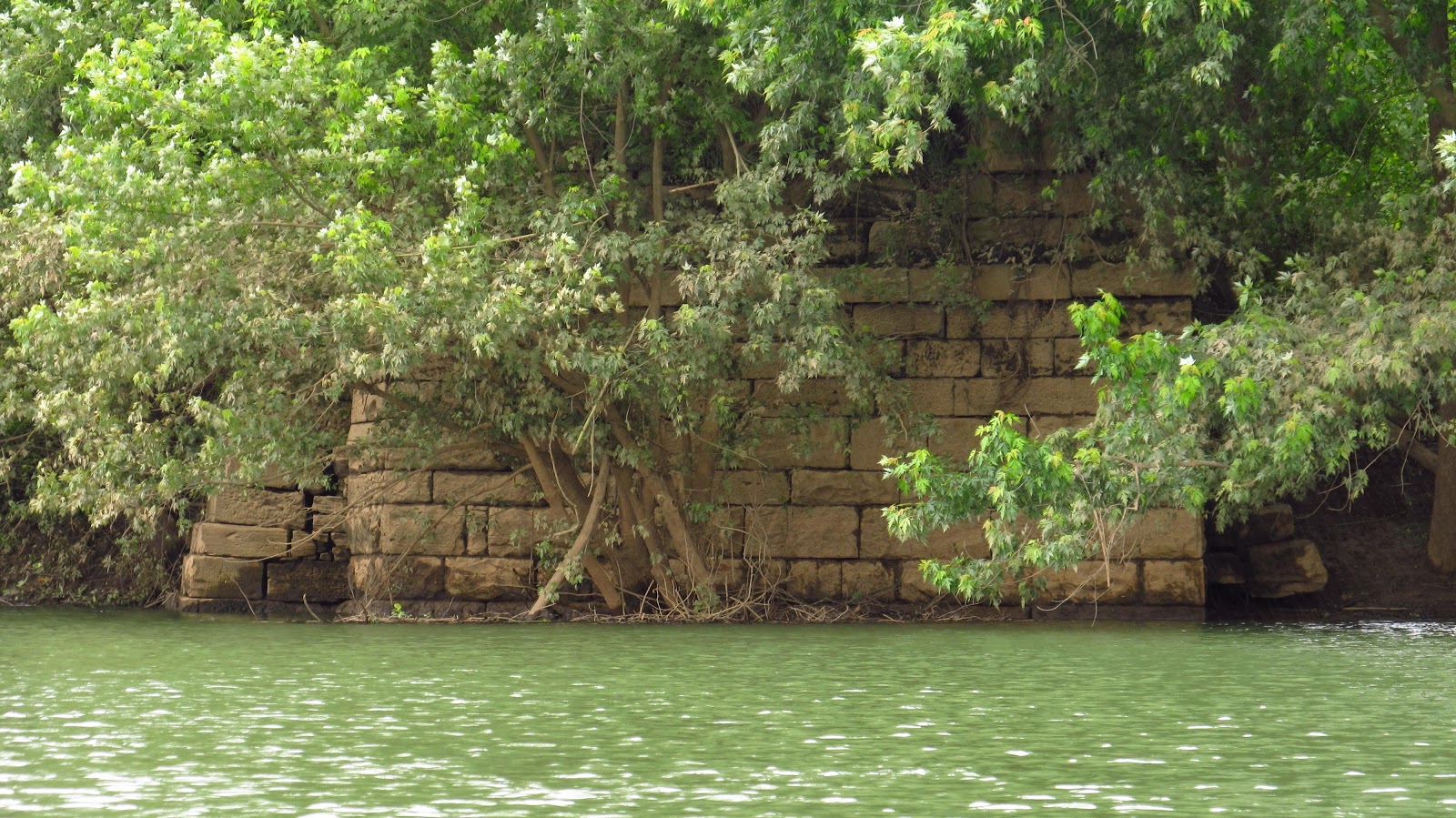
The 1854 abutment in the foreground, and it's replacement, the 1907 bridge in the background. |
 |
Again, notice the differences in the rough cut stone toward the back and the dressed stone at the front. I believe the rear of this abutment was buried prior to the flood control project. The water washed the fill away. It explains the difference in craftsmanship. The abutment on the other side of the river supports this theory. |
 |
Notice the drill marks from when this stone was cut. This abutment is a truly unique example of how these were constructed. Obviously, great pride was taken by the stone masons. All visible stone was dressed. This back stone were probably pieces that were broken or didn't cut properly. |

 |
A more common example of a mason mark. No, I didn't carve it. |
 |
I have seen this mark in other places in the Conemaugh Valley. |
 |
The other side of the abutment. Same situation with the stonework. |
 |
Heading across the river to the other abutment. I have reached this before by land but have never seen the front before. |
 |
A really unusual mason mark. |


 |
The front of the abutment. |
 |
Remember what I said about the other abutment being buried at one time? This definitely supports that theory. |
 |
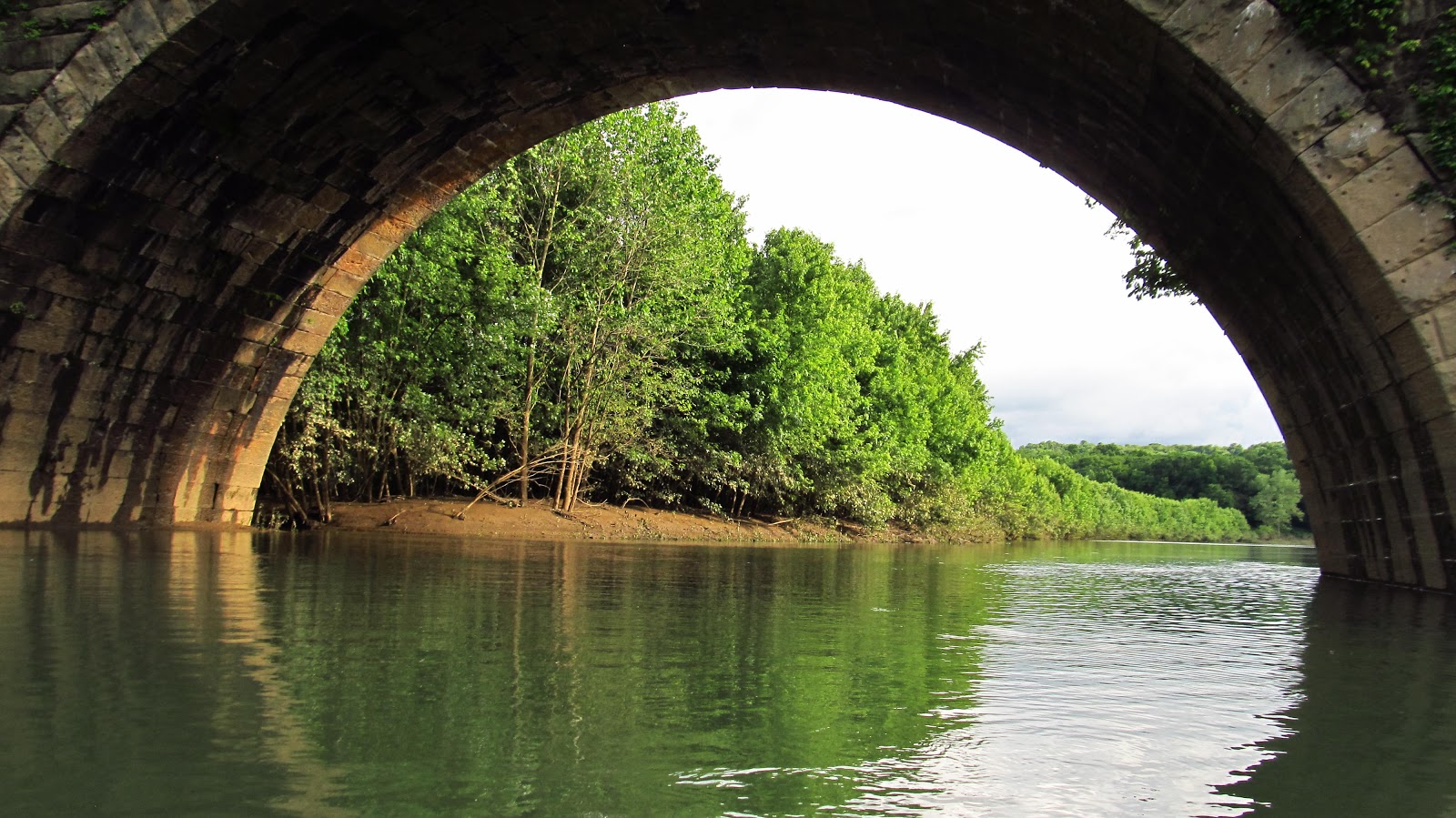
Back to the 1907 stone arch bridge. This is the second bridge heading from the Bow Ridge tunnel, or the West Penn Trail switchback. |


 |
Between this bridge and the Bow Bridge the river is lined with steep cliffs. Prior to the flood control these banks were probably a lot higher from the river. The water starts getting really deep here. This is also the area where I saw the bald eagle. He was much quicker than me. |
 |
This is as close as I got to this bridge. The water was up to the top of the arches and there is always a field of debris before the bridge. This area is extremely deep and I wasn't taking any chances. |
 |
A bridge for the current railroad alignment. |
Heading back toward Livermore.
 |
This is the section on the map I named Livermore Bay. |
 |
Livermore Bay on the right, Conemaugh River on the left. |
 |
Approaching Livermore bridge. |


 |
This is part of the abutment for the bridge that connected Livermore and Filmore. |
 |
This old postcard I have shows the bridge. I believe it was taken from the Filmore side due to the houses behind the bridge on the right side. From the maps I've seen, most of Livermore was south of the bridge. |
 |
Back to the Filmore side of the bridge. |
 |
This would have been the main street in Filmore. |
 |
A photo of Filmore. I don't remember where I got this, it was on my computer. It might have been from Blairsville Historical Society. |

 |
Old lumber from the bridge abutment. |
 |
Livermore bridge. We're getting there.... |
 |
Downtown Filmore. I really needed a bathroom break after being on the kayak for hours. I decided to stop here and jumped right into the ankle deep mud. |
 |
Just liked Livermore, there is no visual evidence of there ever being a town here. Any foundations that may have remained have been long buried in mud. Any concrete streets or sidewalks are also long buried. |

 |
| Looking across from the Livermore side. |
 |
| Before the Livermore Bridge is the Gulf of Filmore. This is another view of the site of Filmore. |

 |
| Heading out into the gulf. |
 |
| This is the osprey I saw. |

 |
| At the far end of the gulf I found the far left section of the Livermore bridge. It was flooded just enough to paddle through it. |


 |
| A number "8" I found carved into one of the arch stones. |

 |
| On the other side of the arch I found what could be a "7". It looks more like somebody was playing hangman with a chisel. |
 |
| The gulf. |
 |
| Livermore bridge! I told you we'd get there! |


 |
| Between Livermore bridge and the last bridge was this little cove with a small waterfall. |
 |
| The final bridge! |

 |
| This big helicopter flew over. |

 |
| Notice how much more shallow the water is up at this end. The arches are almost completely exposed. |
 |
| Notice the water behind the arch. I ended up going back there and what I found was amazing. |


 |
| Heading back under the arch. |
 |
| It led straight into an old section of canal. I was able to get around this obstacle and got to paddle on the canal for about 100 yards. |


 |
| Looking back out the canal. The arch was actually built in the center of it. |
 |
| Arch built in the canal bed. |
 |
| Final looks at the bridge. Time to go get something to eat. |


10/14/2017
A very unseasonably warm day. I hit the water again. The water was a lot lower than it was in June. I went up into "Livermore Bay" and located a nice cut stone culvert in the original 1864 railroad grade.


 |
The culvert under the original railroad grade. This would have been underwater earlier in the summer. |
 |
More photos of the original 1864 West Penn Railroad grade. |


10/21/2017
Another insanely nice day. Another trip out to Livermore. Today, with the water incredibly low, I went out to look at the old piers that were underwater over the summer. They didn't disappoint . There are still iron rods sticking out of the top that the bridge would have been attached to. The only potential mason mark I could see is probably just somebody's carved initials. We'll get into that in a little bit. I did locate additional mason marks on the west abutment that were underwater before. The east abutment was on dry land today. I also looked again at the old Filmore side abutment for the road bridge between there and Livermore.


 |
The stone is still incredible. Especially after being underwater most of the time. |
 |
Remnants of the iron rods that held the bridge together. |


 |
The western pier with the western abutment in the background. |


 |
This is the only potential mason mark visible on the piers. I have my doubts. The water throughout this section of river averaged around two feet. That's not a scientific measurement. That's just an estimate from putting my paddle in and touching bottom. However, around these piers it was well over paddle deep. Maybe it was a swimming hole and people jumped off the piers in the summer. Somebody may have carved his initials. I kind of doubt this too because the quality of the water, up until the past decade or so, was nothing you'd want to swim in. I still don't think it's ideal for swimming. So these initials are a mystery for the ages. |
 |
The top of one of the piers. The second bridge from Bow Ridge in the background. |
 |
Eastern pier with the eastern abutment in the background. Remember in the summer when we paddled right up to the abutment and well up the grade? It's landlocked now. |
 |
Top of a pier. Bent iron. |
 |
Another one of those Knight's Templar looking mason marks. The lower one was underwater in June. |
 |
The field and trees in the background are where we paddled to the eastern abutment in June. |
 |
The Eastern Livermore/Filmore Bridge pier. |

 |
This was underwater in June. |


 |
A drain toward the bottom of the abutment. There was an old pipe inside but it didn't turn out in the photo. |
 |
Great Blue Herons! |


 |
Catching a fish. |
Mike. Nice find on the eastern most bridge. I think it was a tail race for the canal lock that used to be off to the right in that shallow bay. It does look wide enough to be the actual canal. I noticed on Google maps, that section goes right back into the river.
ReplyDeleteAlso, if you want to walk to the 1854 Alignment bridge, Park at Livermore, and walk behind where the 1907 Station sat. To the left is a path that winds up into the woods towards a small clearing. At the northwest end of that clearing you can walk down into a little ravine, full of junk and old bottles-worth grabbing if you can. Then walk up the hill on the other side, and you will be walking on the grade, and soon the bridge pier. Took my family dog there about 7 years ago. Like yourself, I had always wanted to get over there. Cool observation of the stones.
Very cool. Thanks for writing. I know the path you're talking about. I never walked back there before. You definitely had me at old bottles. That's another thing I enjoy. Guess I'll bring a bucket. I'll definitely put that on my fall schedule. Thanks again!
Deletefreakin awesome exploration and finds... adding to our understanding of history... you are a neo-archaeologist... STG Boy no2
ReplyDeleteThanks Mike!
DeleteFascinating way to see the old PRR construction, by boat! I did a walk along the right-of-way/trail and explored several of the bridges a couple years ago. One of them has a metal builder/date plate on it (sorry, don't recall which one at this moment). A mile or so east, I did find a portion of the canal exposed in low water conditions. A fascinating area!
ReplyDeleteEric Johnson
Thanks Eric! I know the plate you're talking about. It's on the side of the bridge where Livermore was. I have a photo of it somewhere on here.
DeleteThanks for posting the pictures of the outlet of that old stone box culvert. I decided to see it for myself, so I went to Livermore yesterday. I hacked my way through the weeds & under brush to get to Livermore bay. The outlet was under water, but I found the inlet on the other side of the 1854 RR grade. I shined a flash light down inside that culvert. Water from the river was backed up half way inside the culvert, so it’s probably open, and the culvert seemed to be in fairly good shape. The only problems that I found was that the inlet needs cleaned out and fill was infiltrating through the first joint between the top head wall stone and the first roof stone. Not bad for not being inspected for at least 110 years! I then hacked my way along the 1854 RR bed all the way to the east stone abutment. The RR bed goes through a cut after the curve at Livermore. I found a couple of old ties. All in all, I really enjoyed the excursion. Thanks for posting your pictures of the outlet of that old culvert, otherwise I never would’ve known that it existed.
ReplyDeleteMike, my email address is ke3wn@yahoo.com. If you send me your email address I'll email you the pictures that I took of the inlet of that culvert along with other pictures that I took during my last two excursions to Livermore.
ReplyDeletePat, I got your message. I responded. I'll try sending you an email. Thanks!
Delete