Today I met up with a couple friends in Normalville and we went on some hikes. The first iron furnace, Fayette Furnace AKA Bucks Run Furnace, was one I had scoped out over the summer but it was too overgrown to do anything. The second, St. John Furnace, was something I've wanted to get to for a couple years. This one took some effort but was well worth it. After that we went to an old sandstone quarry out on state game lands near Dunbar. I haven't been able to find much information about this place. It was definitely an interesting experience though.
So let's get on with it....
Fayette Furnace
Once again these descriptions are going off of the 1966 book "A Guide To The Old Stone Blast Furnaces In Western Pennsylvania"- Sharp, Thomas. There are discrepancies in the history of this furnace. One account has it being built in 1815 by Freeman, Linton, and Miller. The other has it being built in 1827 by James Rogers and Associates. By 1832 the furnace was in the hands of John and George Rogers, employed 40 to 50 people and "produced pigs and castings about 500 tons". The furnace was blown out in 1840. So that's that.
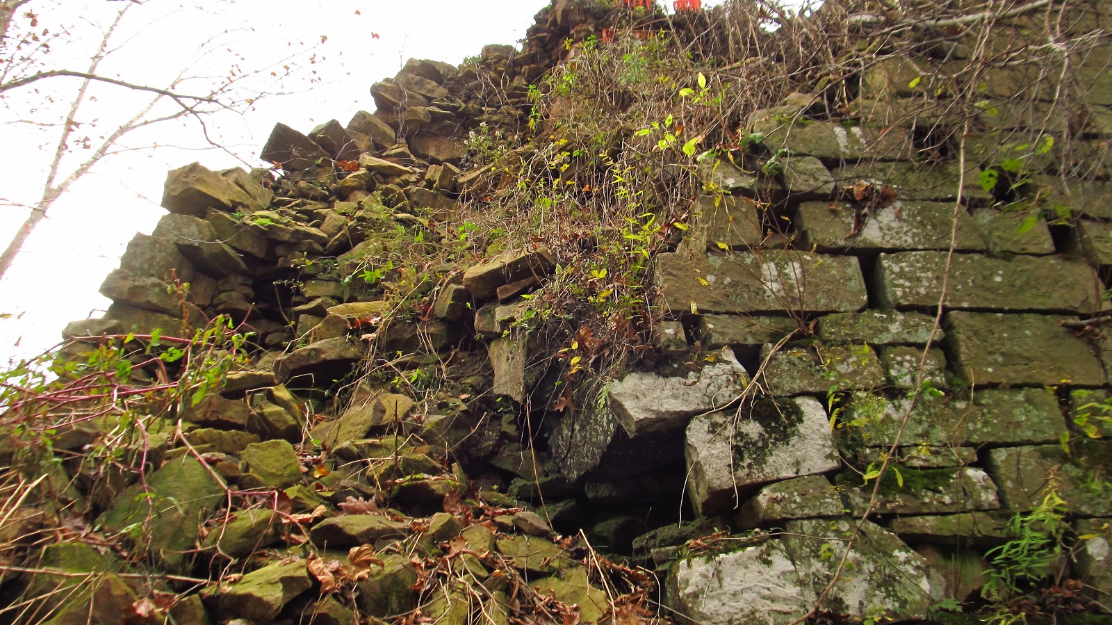
Three sides of the furnace are intact. The back side, facing Buck Run is half collapsed. The collapsed section sort of twisted the remaining corner, and appears to be slowly pulling that down as well. Other than that it's a nice, easy furnace to visit. The easy part is also a curse because people with nothing better to do found it a convenient location to spray paint nonsense.
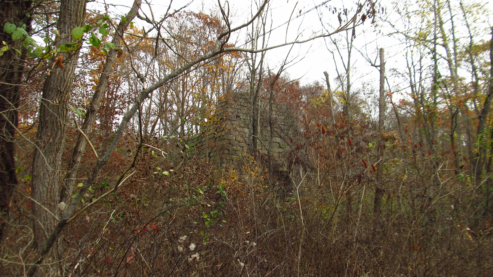 |
Approaching Fayette Furnace. |
 |
The furnace arch on the west side. I believe this was the working arch. Traces of the race can be seen on the other side. If there was an arch on the creek side, it would seem to basically useless. The furnace sits maybe five feet from the creek. The part that crumbled is laying in the stream bed. |
 |
A closer view of the working arch. |
 |
Inside the arch. Still not bad considering it was blown out 177 years ago. |
 |
The top portion of this arch. |
 |
This is the other arch. |
 |
The corner of the furnace and the other arch. Notice the left side being pulled back toward the crumbled portion. |
 |
The corner between the other arch and the crumbled section. |
 |
The creek side. |
 |
A small portion of the mill race. |
 |
Notice the rubble in the creek. |
 |
Half crumbled side of the furnace. When the book was published in 1966, this furnace was completely intact. |


 |
A little more of the race. |
 |
The other arch. Try and see past the moron expressing the extent of his IQ. |
 |
A closer view of the top of the arch. |
 |
Nice old iron holding the arch up. |
 |
This is an attempt to climb over the rubble to get to the final side of the furnace. |
 |
It really wasn't happening so this is the top section of the collapsed corner. |
 |
Looking over the collapsed portion to the intact section. |
 |
Inside top of the furnace. It's hard to see anything from this angle. |
 |
To the right is the side that is tricky to get to. |


 |
Looking up Buck Run. The furnace is shrouded on the right. |
 |
These are taken from the hill on the other side of Buck Run. This would have definitely been the charging side. |
 |
The furnace rubble lying in the creek. |
 |
From this angle you can see some of the bosh. |
 |
A couple more from the hill. |

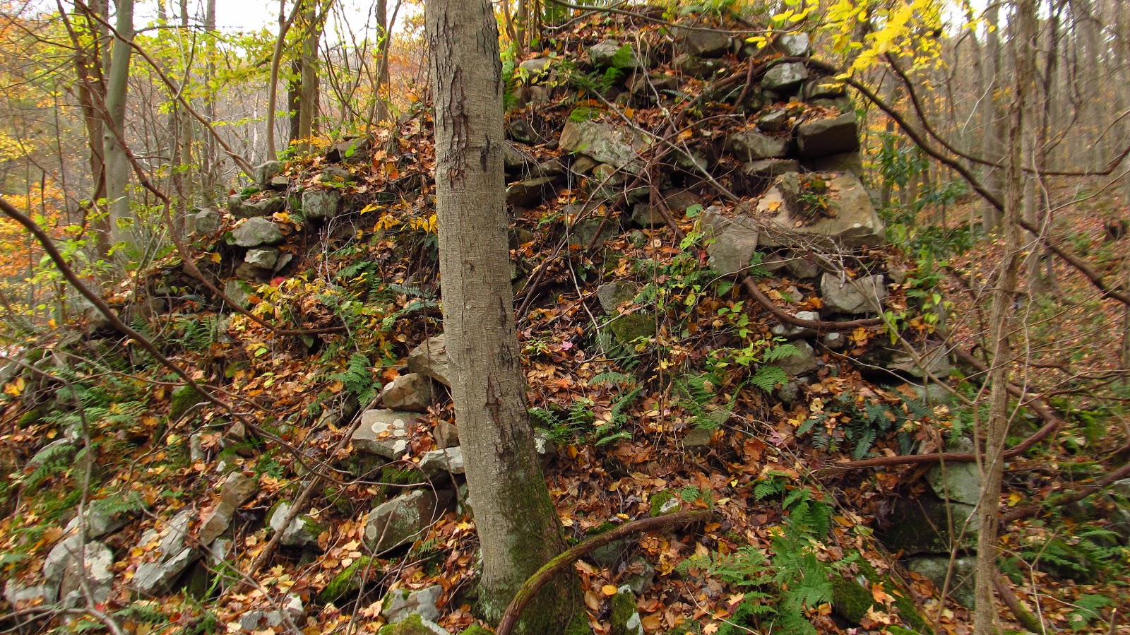
St. John's Furnace
This is the one I was really excited about getting to. It's not an easy one to reach. It sits along a very isolated section of Indian Creek, almost halfway between the reservoir and the Youghiogheny. To get down here we had to climb down the side of a hill and use old logging roads to work our way to the creek. It's a really nice area though and it was fun. My friend CJ was back here before doing geocaching so I just followed her.
According to the book, St. John's Furnace was built between 1810 and 1815 by Jackson and Gibson. The furnace went out of blast in 1828. That's all there is about that.
This furnace is a "stepped" furnace, which means the entire outer walls are not straight. They sort of form levels. See Baldwin Furnace for a good example. It's in pretty bad shape but it's also 207 years old.
 |
Getting closer! We hit Indian Creek. |
 |
Approaching St. John's Furnace. |
 |
The creek side is collapsed. |
 |
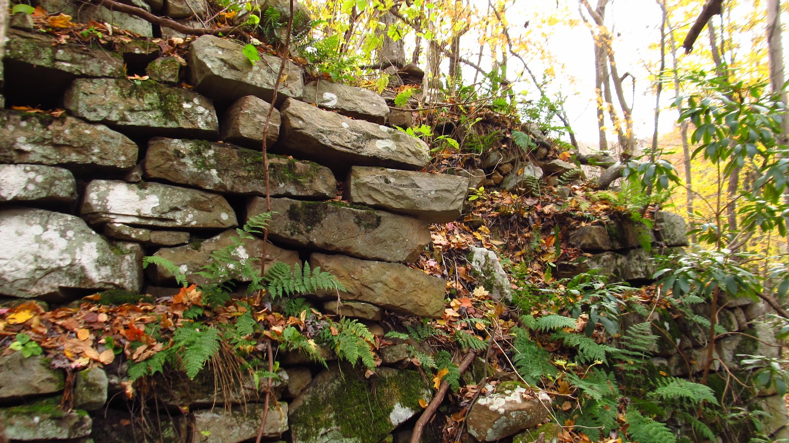
This is really the only good side. Half an arch remains. |

 |
I guess that's why there are three in a row of the same thing.... |
 |
The good side and a piece of the charging side buried in its own rubble. |
 |
The other part of the charging side. You can see the "step" towards the middle of the photo. |
 |
Looking from the charging hill. The step is visible here. |
 |
From the hill looking toward the creek. |
 |
This would be the corner of the collapsed east side and the charging side. |
 |
The millrace. This is almost fully intact. It formed a sort of moat around the entire furnace, exiting the creek on the east and flowing back in to the west, |
 |
The side facing the creek. |
 |
The falls on the creek. |
 |
One of the corners. |
 |
Today was the day of the rhododendron. |

 |
West section of the millrace. |
 |
Part of the wheel pit. |
 |
Another part of the wheel pit. |
 |
More race on the west end. |
 |
Western side of the furnace. |
 |
This would have probably been the blast arch due to its proximity to the wheel pit. The work arch is probably buried under tons of rubble. |
 |
Close up of the wheel pit. |
 |
More race. |
 |
A couple more views from the west. |

 |
Meanwhile CJ found the geocache. First time its been found since 2013. |

 |
A few more shots of the creek and falls. This place is amazing. |


After this we headed over to Dunbar to see the sandstone quarry. Like I said in the beginning, I really don't know anything about this place. I do know that the massive "caves" were only sealed up recently. You could walk through them only a year or two ago. Please leave a comment or email me if you have information on this place.
 |
One of the sealed entrances. These things are absolutely massive. |
 |
The other entrance. |
 |
A huge carved out shelf in the quarry. |

 |
A slate seam running through the sandstone. |
 |
Up above this is a huge subsidence hole. You can see both sides of the tunnels from here. |

 |
You can see how shallow this was mined. |


 |
A couple scale comparison shots to see how huge these seals are. |

Thank you so much for doing the work and sharing the information.
ReplyDeleteGreat photos and great information thanks for sharing
ReplyDeleteThe Dunbar caves were being used to explode metals together for All Clad pots and pans. This was about 10 or 15 years ago.
ReplyDeleteInteresting. Thanks!
DeleteThank you for all of the posts and info. I means so much to me to even see then and now the place my great grandfather worked so hard at. Brought tears to my eyes! THANKS AGAIN!!
ReplyDeleteThis comment has been removed by a blog administrator.
ReplyDeleteWhat do you know about the Erie Coke corp ? (Now defunct)
ReplyDeleteWhat does anyone know about the old iron furnace north of Dunbar-Ohiopyle Rd. Due east of Dunbar, Pa ? Not far from Liston schoolhouse, furn located on Morgan run, first saw it in 1972. On Pa. State game lands #51.
ReplyDelete