Today I took to the water to explore some areas that are inaccessible by foot. I've done about everything I could with these bridges on foot and by bicycle. I've always wanted to get under the bridges, explore abutments from the old 1854 bridge, and look through the flooded areas of Livermore and Filmore. It was great! Aside from the bridges I saw a bald eagle, great blue heron, hawk and osprey. This place doesn't look very large on a map, but it took me seven hours to paddle this whole section.
 |
Headed to the first stone arch bridge of the day. This is the second bridge heading east from Bow Ridge and the old railroad tunnel. |
 |
You can see the old rail grade heading back from the abutment. |
 |
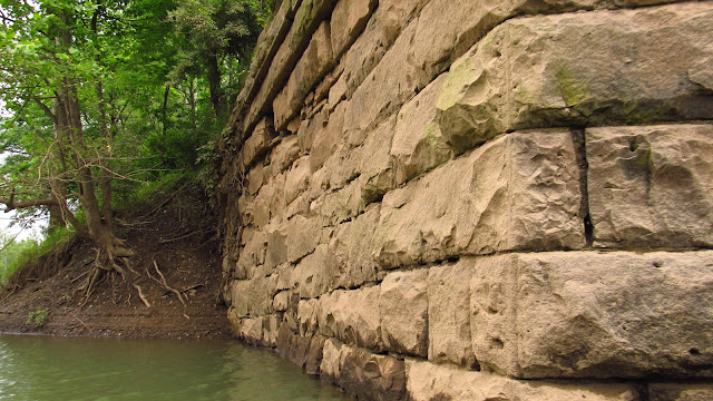
I am a sucker for cut stone. It absolutely amazes me. This stone was laid 163 years ago and it is still perfect. |
 |
After countless floods, thaws and freezes, this stonework has remained completely intact. The old masons were unbelievable. |
Mason Marks and Stonework:
 |
When the stone masons cut stone, they would leave their mark in the stone to get credit for their work. |
 |
I have been reading these mason marks for a few years and this is the first time I've ever seen a mark that looks like a Knight's Templar symbol. |
 |
A more common type of mason mark. Look for these next time you see old stonework. They are very common on old bridge piers and abutments. |
 |
The stone toward the back of the abutment is more rough cut. |
 |
It's unique in the way it's fitted. Notice the drill marks from when the stone was being cut. |
 |
Thick, heavy vines haven't damaged the stonework either. There is no mortar in these old abutments. All this stone is cut and fitted. |
 |
Detail from the 1900 Latrobe quad topographic map. |
 |
Another view of the old railroad grade. |
 |
The 1854 abutment in the foreground, and it's replacement, the 1907 bridge in the background. |
 |
A more common example of a mason mark. No, I didn't carve it. |
 |
I have seen this mark in other places in the Conemaugh Valley. |
 |
The other side of the abutment. Same situation with the stonework. |
 |
Heading across the river to the other abutment. I have reached this before by land but have never seen the front before. |
 |
A really unusual mason mark. |
 |
The front of the abutment. |
 |
Remember what I said about the other abutment being buried at one time? This definitely supports that theory. |
 |
Back to the 1907 stone arch bridge. This is the second bridge heading from the Bow Ridge tunnel, or the West Penn Trail switchback. |
 |
A bridge for the current railroad alignment. |
Heading back toward Livermore.
 |
This is the section on the map I named Livermore Bay. |
 |
Livermore Bay on the right, Conemaugh River on the left. |
 |
Approaching Livermore bridge. |
 |
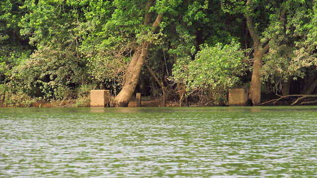
This is part of the abutment for the bridge that connected Livermore and Filmore. |
 |
Back to the Filmore side of the bridge. |
 |
This would have been the main street in Filmore. |
 |
A photo of Filmore. I don't remember where I got this, it was on my computer. It might have been from Blairsville Historical Society. |
 |
Old lumber from the bridge abutment. |
 |
Livermore bridge. We're getting there.... |
 |
Downtown Filmore. I really needed a bathroom break after being on the kayak for hours. I decided to stop here and jumped right into the ankle deep mud. |
 |
| Looking across from the Livermore side. |
 |
| Before the Livermore Bridge is the Gulf of Filmore. This is another view of the site of Filmore. |
 |
| Heading out into the gulf. |
 |
| This is the osprey I saw. |
 |
| At the far end of the gulf I found the far left section of the Livermore bridge. It was flooded just enough to paddle through it. |
 |
| A number "8" I found carved into one of the arch stones. |
 |
| On the other side of the arch I found what could be a "7". It looks more like somebody was playing hangman with a chisel. |
 |
| The gulf. |
 |
| Livermore bridge! I told you we'd get there! |
 |
| Between Livermore bridge and the last bridge was this little cove with a small waterfall. |
 |
| The final bridge! |
 |
| This big helicopter flew over. |
 |
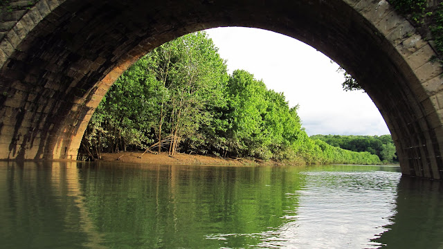
| Notice how much more shallow the water is up at this end. The arches are almost completely exposed. |
 |
| Notice the water behind the arch. I ended up going back there and what I found was amazing. |
 |
| Heading back under the arch. |
 |
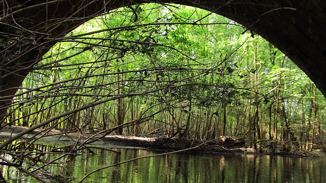
| It led straight into an old section of canal. I was able to get around this obstacle and got to paddle on the canal for about 100 yards. |
 |
| Looking back out the canal. The arch was actually built in the center of it. |
 |
| Arch built in the canal bed. |
 |
| Final looks at the bridge. Time to go get something to eat. |
10/14/2017
A very unseasonably warm day. I hit the water again. The water was a lot lower than it was in June. I went up into "Livermore Bay" and located a nice cut stone culvert in the original 1864 railroad grade.
 |
The culvert under the original railroad grade. This would have been underwater earlier in the summer. |
 |
More photos of the original 1864 West Penn Railroad grade. |
10/21/2017
Another insanely nice day. Another trip out to Livermore. Today, with the water incredibly low, I went out to look at the old piers that were underwater over the summer. They didn't disappoint . There are still iron rods sticking out of the top that the bridge would have been attached to. The only potential mason mark I could see is probably just somebody's carved initials. We'll get into that in a little bit. I did locate additional mason marks on the west abutment that were underwater before. The east abutment was on dry land today. I also looked again at the old Filmore side abutment for the road bridge between there and Livermore.
 |
The stone is still incredible. Especially after being underwater most of the time. |
 |
Remnants of the iron rods that held the bridge together. |
 |
The western pier with the western abutment in the background. |
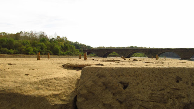 |
The top of one of the piers. The second bridge from Bow Ridge in the background. |
 |
Eastern pier with the eastern abutment in the background. Remember in the summer when we paddled right up to the abutment and well up the grade? It's landlocked now. |
 |
Top of a pier. Bent iron. |
 |
Another one of those Knight's Templar looking mason marks. The lower one was underwater in June. |
 |
The field and trees in the background are where we paddled to the eastern abutment in June. |
 |
The Eastern Livermore/Filmore Bridge pier. |
 |
This was underwater in June. |
 |
A drain toward the bottom of the abutment. There was an old pipe inside but it didn't turn out in the photo. |
 |
Great Blue Herons! |
 |
Catching a fish. |


