Season has officially begun! Today Lou and I headed up to Butler County to get a closer look at Winfield Furnace and the former town site of West Winfield. Winfield Furnace isn't as old as some of the iron furnaces we have visited. The furnace wasn't built until 1847 and was constructed by William Speer. Speer operated the furnace until it was sold to the Winfield Coal Company in 1856. After that, the furnace was purchased by William Stewart and the furnace went out of blast in 1864. Initially the furnace was powered by water but was later switched over to steam. This was a charcoal fueled furnace and produced around 40 tons of iron per week. This furnace is starting to show its age. The large stones are starting to crack and crumble from the inside, and a collapse of the northern side is inevitable unless some preservation work gets underway soon. This furnace is approaching its 172nd birthday. We were able to locate a possible water race and found some slag near the creek. The terrain has been very altered over the years. By the time this oven went out of blast, it witnessed a town grow up around it and then watched the town disappear. It saw a railroad get built next to it and it watched it fall into abandonment.
The former town of West Winfield, which today only a few traces remain, was a company town constructed to house the workers of the limestone mines in this area. The mining of limestone was the largest industry in this area. There is still a very active limestone mine in operation. F.W. McKee owned the largest limestone mine of it's kind in the world and constructed the town. West Winfield was originally called Winfield Furnace and a post office was established in 1885. It was, however, known as Winfield Furnace in the 1874 Butler County Atlas.
 |
1874 atlas showing Winfield Township. Note the number of limestone mines active in this area.When these limestone mines eventually worked out, they were converted over to mushroom farms. In 1937, Butler County Mushroom Farms Inc. began the first mushroom production in the old mines. This area would turn into the largest mushroom producer in the world. Mushrooms are still produced in this area and some of the old limestone mines have been converted into underground storage. Vital records for the government and military have found permanent storage in the former limestone mines due to their consistent temperature and conditions. This is certainly a unique area, not just in Pennsylvania, but in the world. |
 |
This photo is from the May 1932 Popular Science magazine. West Winfield was certainly a unique place. |
West Winfield as a town appears to have no longer existed by the 1980's. I have been unable to find an exact year when the last house was torn down.
 |
A 1938 aerial view of West Winfield. |
 |
Inset from the 1941 Butler County map showing West Winfield. The railroad is listed as the Winfield Railroad but this was originally a spur of the Buffalo, Rochester, and Pittsburgh Railroad. |
 |
A circa 1919 photo of West Winfield taken from the Franklin News Herald- March 5, 1975 |
 |
A map of West Winfield taken from the Pennsylvania Mine Map database, Penn State University. |
 |
A crate from Butler County Mushroom Farms which is listed for sale (at an unreasonable price) on Amazon. |
 |
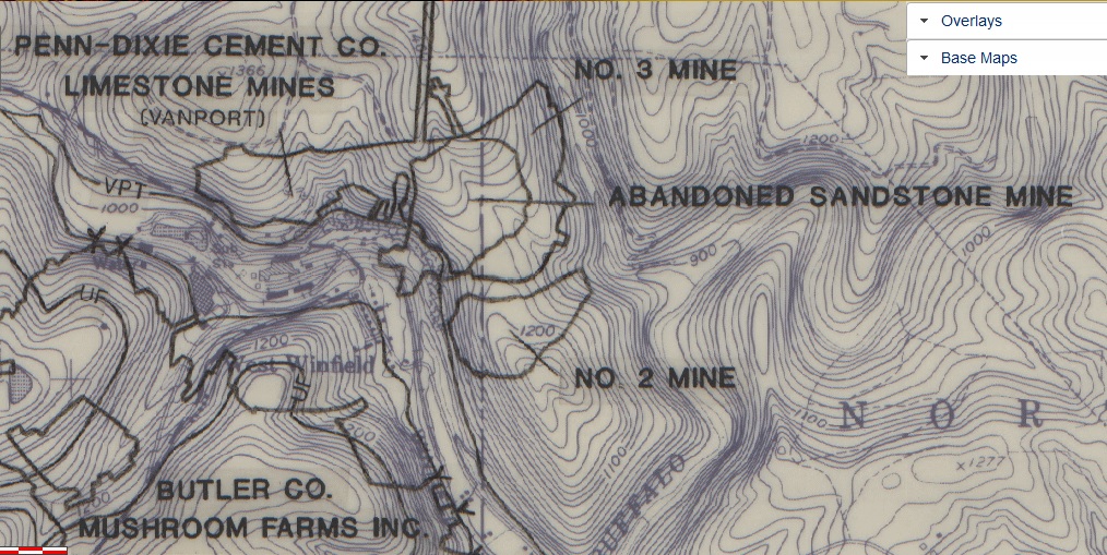
West Winfield from the 1902 quad Kittanning topographic map. |
 |
While walking back to the iron furnace we came across these pieces of huge steel machinery. They look like old steel mill equipment, but considering the area we're assuming they were related to limestone production. |


 |
Enormous pipe. |
 |
This was enormous. |

Lou found these two images while searching online. We believe the two large steel objects are part of a cone crusher which was used in the production of concrete.


 |
Approaching Winfield Furnace. |
 |
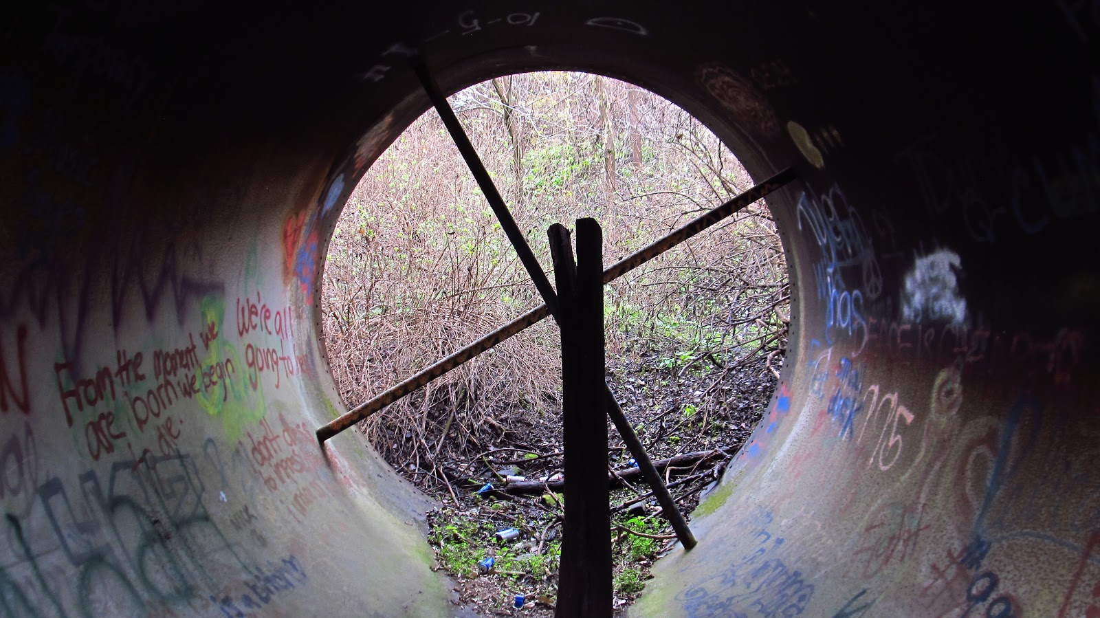
From inside the stack. |
 |
Intact wall of the stack. |
 |
Side where this furnace is starting to fall apart. |


 |

 |
The outside is still very intact. |


 |
Old Buffalo, Rochester and Pittsburgh Railroad bridge crossing Rough Run over to an old limestone mine. |


 |
A tree that met the wrath of a beaver. |
 |
Part of the railroad grade behind the former town. |
 |
Old hopper along the railroad grade. |


 |
Some old foundations next to the hopper. |
 |
Remains of an old switch on the railroad. |
 |
A couple buried railroad ties. |
 |
Front of the hopper. |
 |
One of the denizens of the forest. |
 |
Side of the hopper, looking down at the old town site. |

 |
Looking down the road. The lower section of West Winfield was located in the field on the right. |
 |
One of the last remaining structures just outside of the former town. |
 |
Lou pointed out that there was a new "smart" meter installed on this building. They really are forcing these things on everybody. |
 |
Another remaining structure. |
 |
An abutment along the creek. On the other side is a portal into an old limestone mine. Rough Run was running extremely rough today and there was no way to get to the other side. |
 |
The portal can be seen roughly through the trees. |
 |
Old bricks lining the creek. |
 |
The upper portion of the former town site. West Winfield was located on the field to the left. |
 |
Armstrong Cement Plant. |

 |
One of the conveyors leading up to the limestone mines. |


After this, and since we were in the area, we decided to head over to another ghost town. Yellow Dog is another limestone company town. This town has been abandoned since 2011 when water problems forced the last residents out. In 2014 the entire town was purchased by two people with the hopes of turning it into a historical mining town and preserving the heritage of the area. A very nice article about the town and the plans for its future can be found here.

The sign says it all. We did call the number listed and left a message. We didn't enter the village because we couldn't get permission, but we did get some photos from the road.


The sign says it all. We did call the number listed and left a message. We didn't enter the village because we couldn't get permission, but we did get some photos from the road.


After this we headed up 66 towards New Bethlehem so I could show Lou the old Mack Tunnel on the Pittsburgh and Shawmut Railroad. Mary Jane and me went up there a few years ago so a more detailed history can be found here.

The waterfalls were really running due to the endless barrage of rain.


We were last up here in the summer and this bridge was pretty inaccessible.


West portal of the Mack Tunnel.


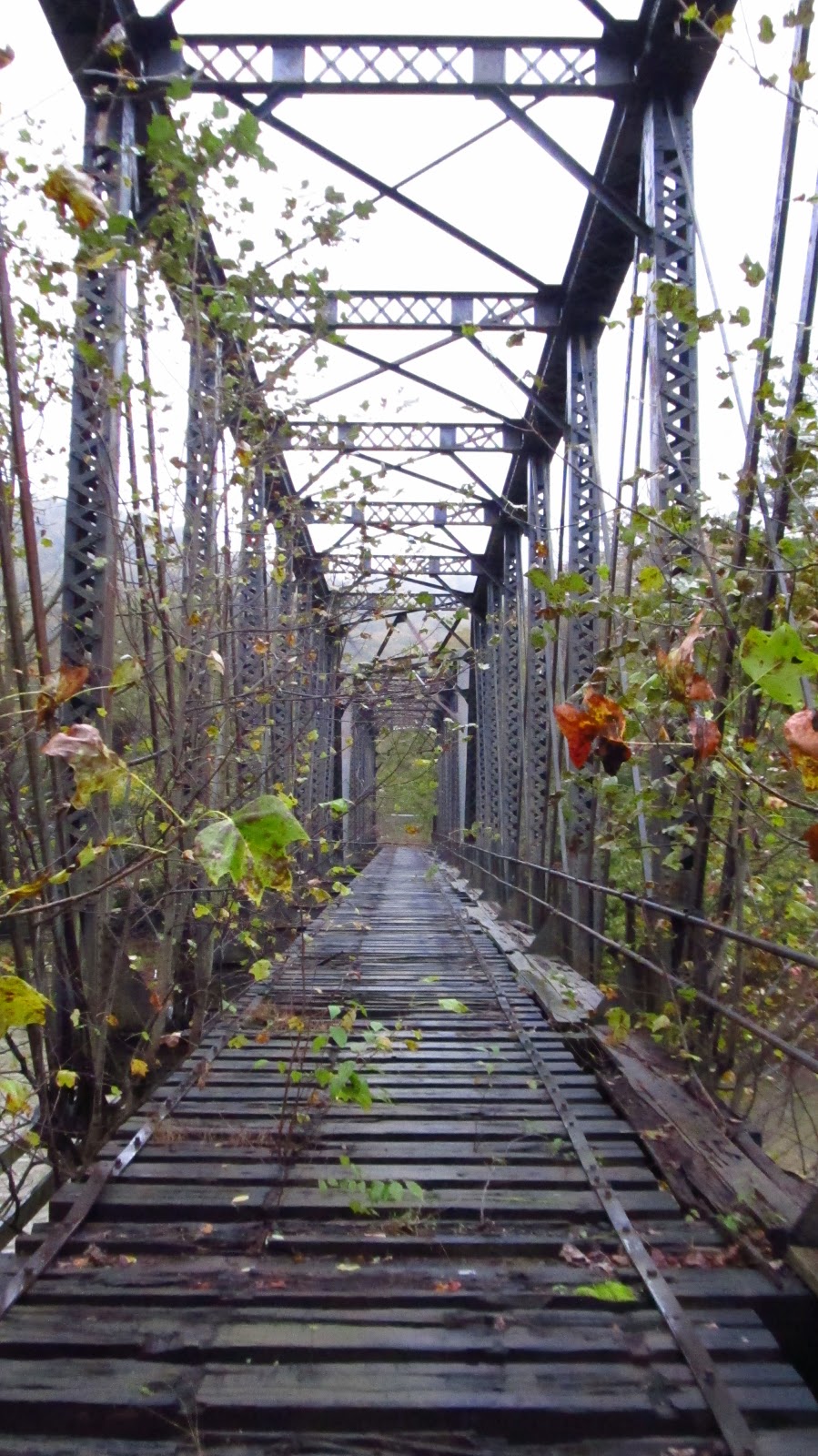
This is a bridge we didn't get to the last time. This massive bridge is on the other side of 66/28.


Some information painted on the side. At the top it looks like there was a plaque, but somebody ran off with that a long time ago.


The waterfalls were really running due to the endless barrage of rain.


We were last up here in the summer and this bridge was pretty inaccessible.


West portal of the Mack Tunnel.


This is a bridge we didn't get to the last time. This massive bridge is on the other side of 66/28.


Some information painted on the side. At the top it looks like there was a plaque, but somebody ran off with that a long time ago.


I grew up in Freeport, PA., lived in Wifield for 15 years, hauled limestone from the former Winfield Lime & Stone since the early 1980's...and drove by the Winfield Furnace a thousand times without knowing of its existence until somebody directed me to it this summer. We practically took the exact photos. The large iron tool appears to be a stone crusher and cone for the crusher. I will be taking the paid photo tour of Yellow Dog on November 18, 2018. All of this in my back yard! Give me a heads up next time you be in my area. https://www.flickr.com/photos/thelimbreaper/29067018067/in/datetaken-public/
ReplyDeleteThanks Brant! I certainly will. I had no idea about the grave site for the influenza victims. Nice talking to you on Facebook.
DeleteThis is fantastic. Thanks for posting.
ReplyDeleteHi Mike,
ReplyDeleteA small correction regarding the abandoned railroad line you found in West Winfield. The bridge and abutments you found over Rough Run belonged to the Winfield Railroad. I know the topo map says Buffalo, Rochester and Pittsburgh, that is incorrect. The BR&P did have a branch off their mainline to Craigsville, PA. That was as close as they got to West Winfield.
The West Penn Railroad, a Pennsylvania RR (PRR) predecessor, built the line about 1890, and become the West Winfield Branch. The line ran from West Winfield to Winfield Jct.and connected with the PRR Butler Branch. Over time with lime and cement interests, PRR leased the line to those companies, the last operator of the line was Penn Dixie Cement. The lime interests named their railroad the Winfield RR. Over time they had 7 different steam locomotives (all purchased used) and closed out service with a GE center cab diesel. Due to declining traffic and lease cancellation with Conrail in 1979, the Winfield RR was abandoned. In 1980 the railroad was torn up and removed.
About 1978 or 1979 while my father and I were hiking the old line and the Conrail Butler Branch we stumbled upon the GE locomotive on the line. As we approached it, the crew took off for West Winfield! Dang, wanted to see that up close and perhaps talk with the crew (I would have been 13 or 14 years old at the time). Another hike around Winfield Jct, my father and I saw 2 flat cars loaded with large pipe type objects similar to what you photographed. I believe they were new parts of the rotary kiln for the cement plant.
The old building with the smart meter on it was the Pennsylvania Clay Products office and later Winfield Stone and Lime.
I might add the Winfield RR hauled lime, limestone, sand, cement and of all things, horse manure! The horse manure was hauled by rail mainly from Kentucky (from all the horse farms there) and used in the mushroom "mines" to grow mushrooms. Once the limestone mines in the West Winfield and Worthington areas were mined out, the caverns were used to grow mushrooms. PRR-PC and early Conrail hauled manure to interchange with the Winfield at either Butler Jct (in Freeport) or at Winfield Jct.
Much info I wrote was from memory growing up not far from the area and also a book. The book entitled Ghost Rails V, covers the PRR Butler Branch and the Winfield RR and authored by Wayne Cole. I was a big contributor to this book. I believe it is out of print but perhaps can be found on EBay or Amazon.
Thanks for the nice post/report of this area. You always find interesting bits of history that is fading away.
Eric Johnson
Wow. Thanks Eric! I appreciate you clearing that up. I will try and find that book. Thanks again, I really appreciate your information.
DeleteOther books on the area and butler by Brown and James Mckee are also quite useful. For info on the subject but there are still gabs that need filled in.
DeleteGaps can be filled by some other sources, besides brown and James, some train sites have info. I'm still looking for F.W.'s info, which I have a inkling where to go for that.
DeleteI think you can find that book in the library in nearby Worthington. I was just up at West Winfield today. Some of my pics are just like yours, only with snow. I have resided in the area just over 10 years now. I've known about Yellow Dog and WW, for most of that time. I was just looking online for more info after my walk and found your pics. I belong to a 'urban explorer' Facebook group, folks like to see pics of old train stuff.
ReplyDeleteAlso, when I moved to the area around 2006, there were two houses remaining near the bridge over Buffalo Creek, I think they were abandoned at the time. Not long after, they were damaged by major flooding and demolished. There is still a small root cellar located behind where one of those houses stood. I used to be able to see it from the road but now there is more undergrowth.
DeleteThis info is amazing, though I wish this was posted before october 2018 cause my brother was doing some projects on this place for his Liberal arts urban city and for a Geography class last time. This is very helpful for helping yellowdog, its sister city, and for keeping west winfield's history alive. I'm working on that and have and making a few connections to maybe make a book on it, cause the info I found on the whole town is amazing for western pa, Pittsburgh, and for Butler PA. And it kind of pisses me off when looking online that several people, a few majored in history, didn't know where those pics are originally, and I found a train site that had its exact titles and locations correctly. But its possible to save its history and its sister city, both. Which I have to go recontact the Yellowdog owner and give my realizations and research. Wish me luck and would love anyone and everyone's help on making the book and Yellowdog's historic site recognization a reality. Give a shout out if can and would like to help.
ReplyDeleteMy grandfather's both worked and lived here. My dads family lived in a house that stood on the other side of Rough Run right before the bridge over Buffalo Creek. He worked for the railroad. My mom's dad was a blaster in the limestone mine. They lived on a farm that was on the new road going to 422.
ReplyDeleteRegarding the BR&P/Winfield matter. The Geological Survey has antique topographic maps on-line. The Kittanning quadrangle exists as 1900 survey and 1902. The latter was published in several editions in 1902, 1904, 1907, 1912 and a couple other years. Only the 1902 edition shows the railroad into West Winfield as BR&P. All other editions say Winfield Railroad.
ReplyDeleteIf there is any way we could get the coordinates or maps to some of the old sites, the tunnel, the train track, etc. We would like to take our photographer friend who is doing a local history story.
ReplyDeleteIf I remember correctly, there were two general stores and two R.C. churches in WW. They had "May Day" celebrations with a beauty pageant. That was a very big town at one point. Had it's own Post Office, high school also.
ReplyDeleteThis comment has been removed by the author.
DeleteThere wasn't really two Roman Catholic churches in West Winfield. From the research I did for my bro's projects on this town, as I stared in a comment on here before (the geo and Liberal arts urban city class was me), and info I need to give my growing up parish on it's parent parish, there was only one roman catholic parish in West Winfield, aka St Mary's West Winfiled Pa, a spurr off of St Mary's Herman and younger sister church to St Johns, a small white wooden church with a basement from what famiky told me of it and the pic I found of it. The other was considered coylesvile pa, aka St John the Evangalist Parish. If I remember what my Great aunt Diana used to say of that town and maybe also read in the James mckee or Brown books, many went to St Johns cause it was just up the hill. However, many older family locals complained about the new immigrant miners and families ethincs, morals and actions, thus they created St Marys if West Winfield to fix that. Also was the reason later St Joseph's of Cabot was built to also handel the spill over of that town's population too.
DeleteI have a very early image of West Winfield taken by George Finley. The back of the photo says it was the first photo he ever took
ReplyDeleteI would love to send u more pictures I go hiking all thro here an have multiple pictures of the caves
ReplyDeleteI was born in 1944 we moved to west winfield 1950 when I was 7years old and lived there until I was 13. I was the paperboy and have many stories and memorys of this time.One Clover Farm Store run by Adolph Herman, Post Office one Catholic Church, one Protestant Church. All of the photos and different stories I have seen and read I lived them. Am 78 now and still think of those days and going swimming in the summers at second rock in the Buffalo Creek.
ReplyDeleteIf you swam at second rock and later at forty foot. You went to high school with me I am 78 also but grew up on the top of the hill. Use to hitch hike to West Winfield.
ReplyDelete