Sunday, January 27, 2019

A Walk Along the Old Canal in Cokeville

Yesterday, a small group of us got together to take another walk through Cokeville. I have been back there many times, but concentrated exclusively on the town itself, the old railroad alignments, and the coke ovens. Today (yesterday will be referred to as today from here on out) we took a walk out there to try and find the remains of the old canal that ran right through the heart of the former town. We found some of the most extant sections of the Western Division of the Pennsylvania Canal that still contain water. This was a great find in itself, but we learned that a large portion of this canal section is inhabited by beavers. Nothing is better than being with some of your favorite people, exploring lost history, and combining it with an element of wildlife which have adapted, and thrived, in an enormous man-made ditch which stretched across the entire state. So few people are even aware of the Pennsylvania Canal, which was one of the greatest transportation achievements in the history of the state, but became obsolete almost immediately after its completion. 


The canal predated the dawn of the great Pennsylvania Railroad, which would consume enormous portions of the canal either by filling it in to lay its tracks or by using its towpaths. This makes finding sections of the canal that are still intact rare, let alone portions that still contain water. Fortunately, we can still find both if we know where to look. There is still a very intact, and easily accessible section along the West Penn Trail at White Station, as well as a nice section (sans water) near Conemaugh Dam, but finding a large intact section requires a good deal of research. I know I'm of the opinion that everything should be preserved, but the easy accessibility of this site, along with it being located on government land, would make this a great project to understand and interpret this piece of Pennsylvania history. 


 Obviously, we walked up to the coke ovens too...


Down in Cokeville along the river. These are the piers for the bridge that connected this town and Blairsville. This road alignment was an early alignment of Route 217 which connected Derry and Blairsville. More information on Cokeville and my earlier trips to town can be found here and also here.


These photos are of the beaver evidence that we found along the old canal.


Toward the center of the photo you can easily see the this iced over section of canal.


Cliff examining beaver evidence along the banks of the canal.


A nice intact section of canal.


More beaver work.


More canal.


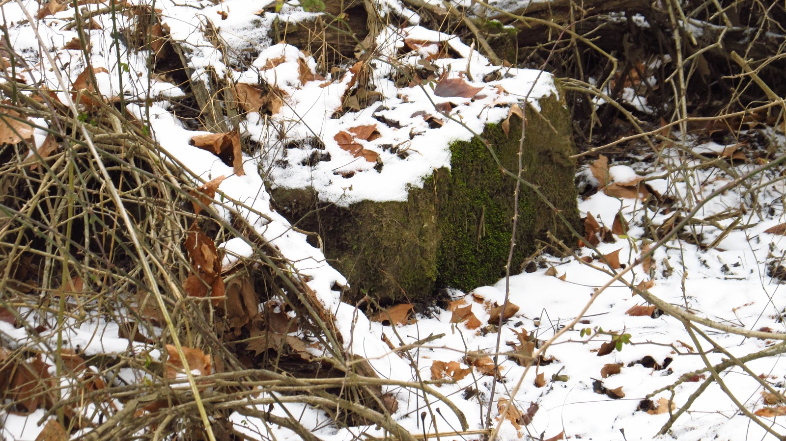
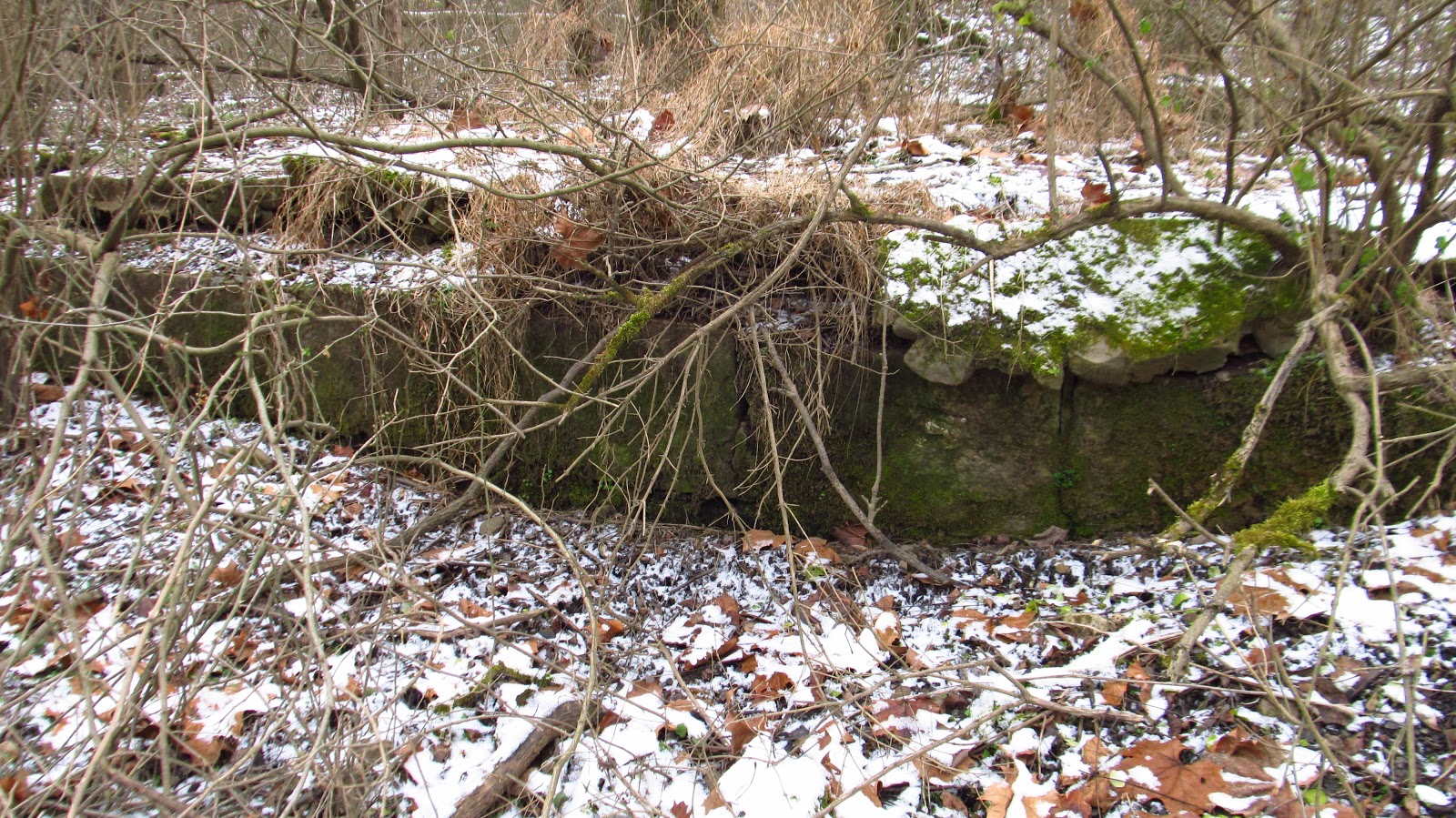
Piers from the old Western Pennsylvania Railroad dating back to ca. 1863.


Another mason mark on one of the enormous cut stones.


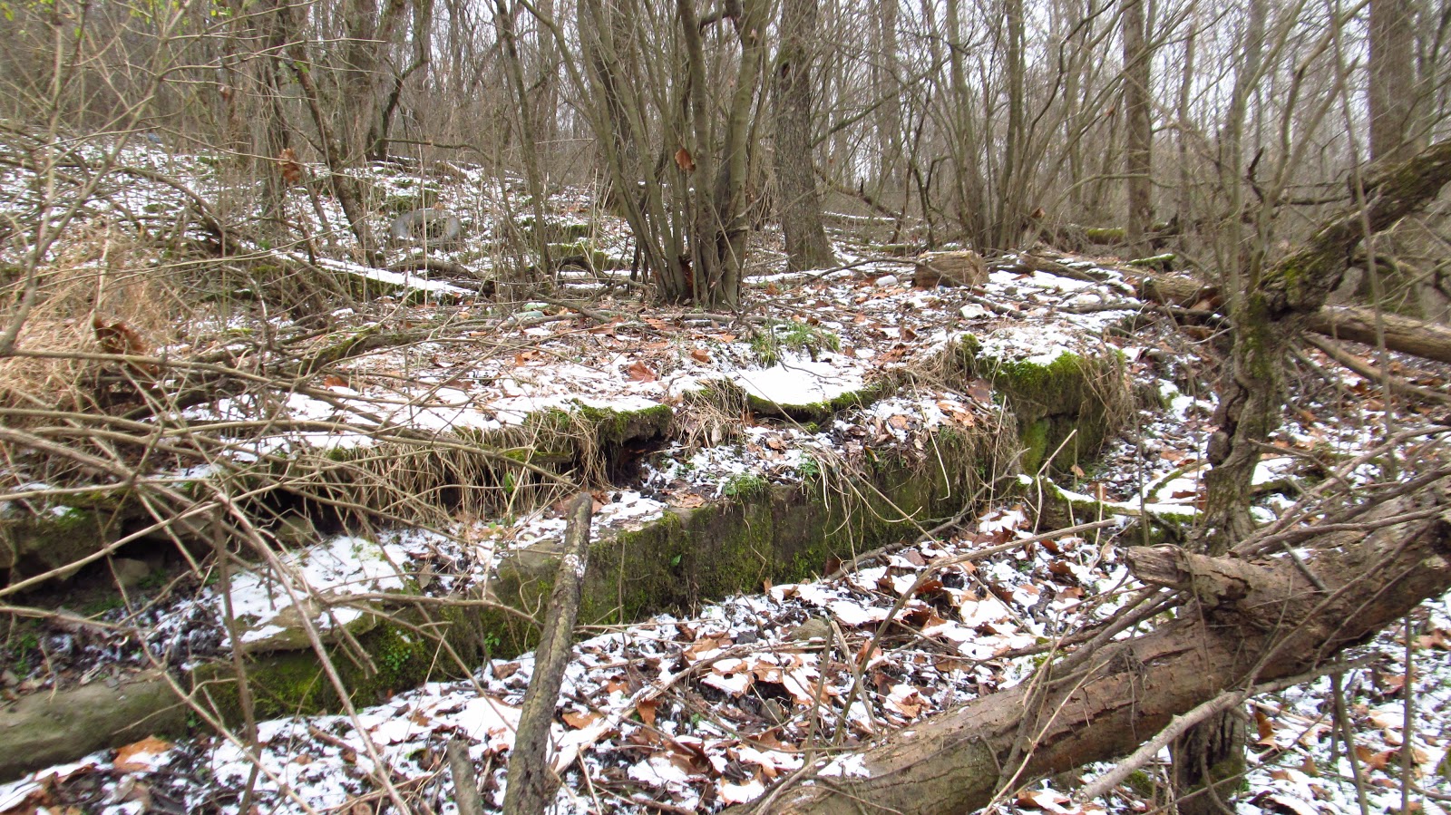
Looking down from the old railroad grade.


Some of the remaining ovens from the Isabella Coke Works circa 1872.


I am standing on the Cokeville Spur of the Western Pennsylvania Railroad, later Pennsylvania Railroad. To the immediate left is the coke pier and beyond that are the ovens and coke yard.


Brother Lou checking out the ovens.


Mary Jane and I discovered this tree during one of our previous trips here. It's still the same. The bottom of this fallen tree contains the entire floor of one of the coke ovens.


Another one of our previous finds. This is a stream running through the center of an old coke oven. The top waterfall is running over the back wall of the oven. The one below that is running over the tile floor of the oven. Below that is erosion from this stream.


A few more of the remaining ovens.


These photos were taken from the field behind Torrance State Hospital.


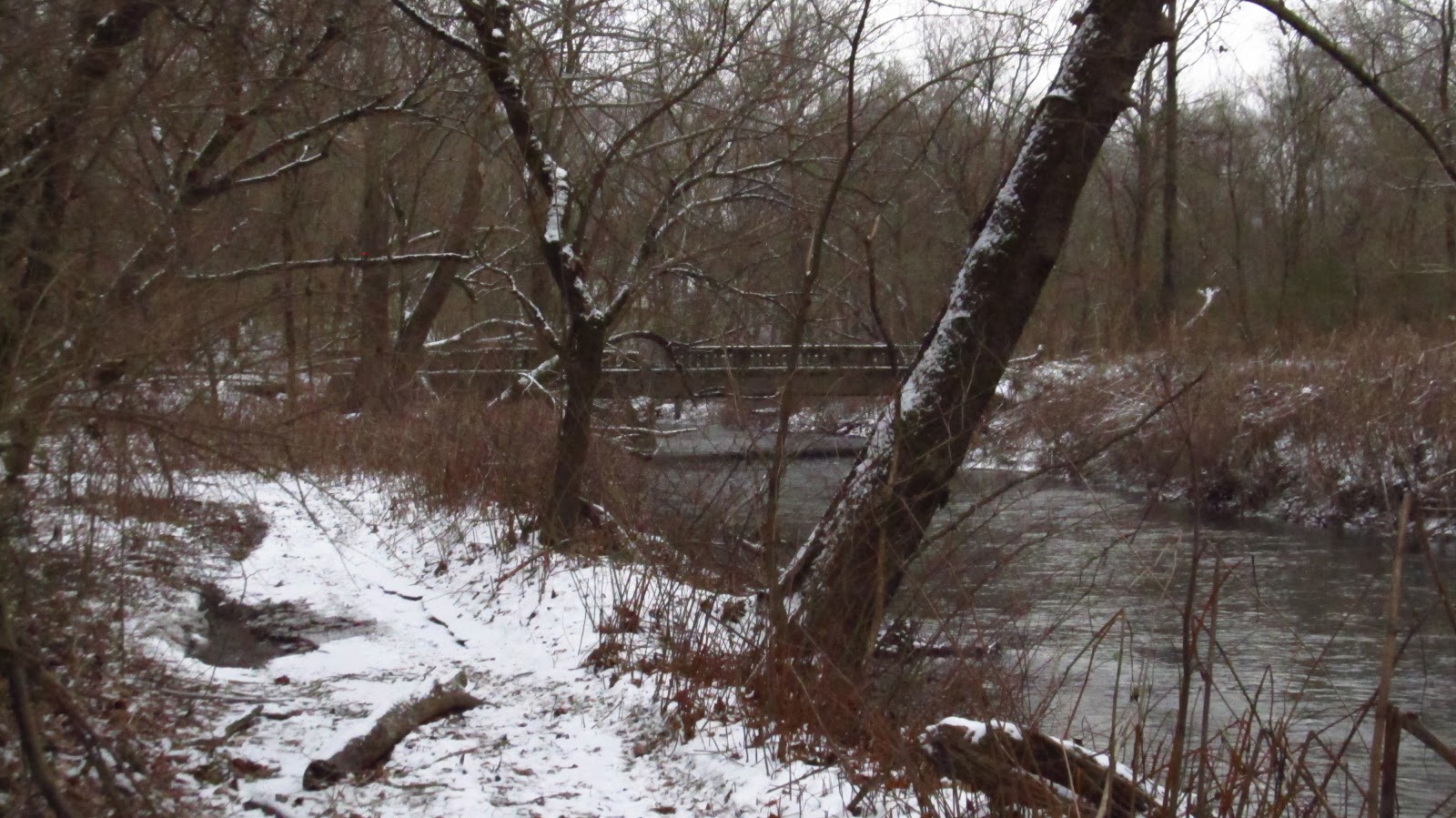
Old bridge crossing McGee Run which led into the town of Cokeville.


Tuesday, January 15, 2019

Another Trip To Livermore

On Saturday, I headed back out to Livermore to dig around a little more and follow the 1863 alignment of the Western Pennsylvania Railroad down to the old bridge approach further downriver. It was something I'd been wanting to do for a few years now, and I decided to keep it local since nobody can predict weather in Pittsburgh anymore. Spoiler alert: it didn't snow. 


Anyway, as we know, there's no indication of the town of Livermore ever existing as far as foundations and structural remains. The railroad alignment sat much higher above the ground and hasn't been subjected to the constant bombardment of floodwaters that buried any trace of the town deep in the mud of the floodplain. Prior to 1907, when the large stone arch bridges were constructed, the railroad largely followed the course of the river, instead of bridging its way across it.  


The 1903 Latrobe Quad topographic map shows the course of the original alignment through this area. A total of three bridges existed between Social Hall and Bow Ridge. I am fairly certain that the Social Hall bridge was reused in the 1907 alignment. Other than that, the four huge stone arch bridges that exist today as part of the West Penn Trail were constructed, straightening the line. This resulted in the bridges west of Livermore and at Bow Ridge being replaced, as well blasting a new tunnel through Bow Ridge. Today I concentrated on the old alignment from Livermore to the first bridge to the west.


This 1953 Pittsburgh Regional Map shows (roughly) how the alignment looked after 1907. Very soon after this map was produced, the railroad was forced to move to higher ground to make room for the Conemaugh Dam flood control project. Social Hall already ceased to exist at the time of this map, but shortly after, Livermore and Fillmore would also be erased from any future maps. 


This 1964 Blairsville Quad topographic map shows how that all worked out.


As I said before, this alignment didn't become active until 1863 when the Western Pennsylvania Railroad opened it. However, it was mapped out, and some of the grading was done several years earlier. In 1853, the North-Western Railroad Company was created to build a line from Allegheny Portage to New Castle. The purpose of the railroad was to build a western route bypassing Pittsburgh and connecting with the Cleveland and Mahoning Railroad at New Castle. Surveying and grading from Blairsville to Butler began in 1854, no track was laid at this time. The North-Western Railroad went belly up due to the panic of 1857. The Western Pennsylvania Railroad Company was formed in 1859 after purchasing the North-Western ROW in foreclosure. Trains started running from Blairsville to Saltsburg in the Fall of 1863. So some of this grading possibly dates back to 1854. There is an enormous cut just above Livermore, and the grade itself still remains very prominent and easy to follow.


Getting onto to the grade was very easy. It's directly behind where Livermore station used to sit, right along the trail.


Livermore Station. Even in this photo, you can see the old grade behind it.


Looking down into the former Livermore town site.


This cut stone sits right below the old railroad grade. It's hard to tell what it's related to. I've looked on the old town maps, as well as old aerials, and all I can come up with is that it was part of the edge of the road. It was certainly part of Main Street, Livermore if that's the case.


Notice Main Street heading up and over (or under?) the railroad.


Maybe this what part of a tunnel heading under the railroad grade? The other side did not contribute to that theory, but the terrain has been changed so many times over the years.


Nice Star arch brick just sitting here. These are typically seen at coke oven sites. No idea why it's here.


The 1863 grade.


Immediately it comes to this old foundation. The old maps really don't suggest much in this area other than the original railroad station house. This may have been part of that.


This 1876 map of Livermore clearly shows the "R.R. Station Ho".


A closeup of that foundation.


More of the grade. This is where it gets a little confusing. This is obviously an intentional dig in the center. The center cut does not line up with the rest of the grade though. The grade itself seems to be on the left. This is too deep to be drainage for the railroad, the canal was located clear on the other side of town, so it's kind of a mystery.


Above it was some more cut stone. Perhaps it was a siding for the old station.


A little further up were these old piers.


Up on the grade again.


Certainly the railroad grade. The cut from earlier is down on the right.


A very odd growing tree.


Left of the railroad grade. I finally got to see the other side of the culvert that I found from the river a couple years ago.


It's still working and flowing.


This is the other side of it and can be found on a previous post by clicking here.


Approaching the huge cut.


An old railroad spike, in an old railroad tie, that has been sitting here since at least 1907.


This cut is flooded. It wasn't cold enough to be frozen completely through so I had to pick my best slushy spots. My feet remained dry and I was successful in my mission.


I did climb the cut on the right before I got to the end. This was too flooded.


Coming out of the cut I noticed a huge foundation on the left. The 1939 aerial shows a farm here, so I'm assuming this was a barn foundation.


The farm is toward the center of the 1939 aerial. The old grade is easily identifiable coming up west of Livermore. The 1907 alignment, and the current West Penn Trail, is at the bottom of the photo.


Closeup of the old foundation.


Toward the center of this photo is a concrete trough that ran the length of the foundation. Further making me believe this was a barn.


Walking out of the farm area. Obvious grade on the right.


Back on top of the grade.


What was interesting about this area was the amount of ballast that remains. This grade does flood, but it's not as frequent as the areas closer to the dam. This grade and bridge approach are really high off the river.


This is looking off the grade and bridge approach at the second stone arch bridge east of Bow Ridge.


Coming up to the top of the old bridge approach.


Looking across at the other abutment. Second stone arch bridge to the left.


The top of the bridge approach. I've always wanted to be up here!


Opposite bridge abutment with the old pad for one of the piers at the bottom of the photo.


These pier pads are not always underwater.  I have paddled up alongside of them in the summer.


Side of the bridge approach. Again, other angles of this can be seen here.


Remains of long gone trees.


Walking back. This time I walked over the top of the cut. This and the following photos are looking down into it. It's hard to tell how deep this cut actually is without seeing it firsthand.


Back in Livermore. The Livermore Bridge is in the background and the old canal basin is in the foreground.


The old town site of Livermore.


After walking around town for awhile, I decided to look for the old abutment for the Livermore/Fillmore Bridge. I was never able to find this in the summer. The Fillmore side is clearly visible from the river but the Livermore side sits further inland. This abutment is buried deep in the flood mud and is completely covered with vegetation in the summer.


The old Livermore/Fillmore Bridge.


A couple more photos of the Livermore side abutment.


Looking across at the Fillmore side.


Looking up along the former Bridge Street in Livermore.