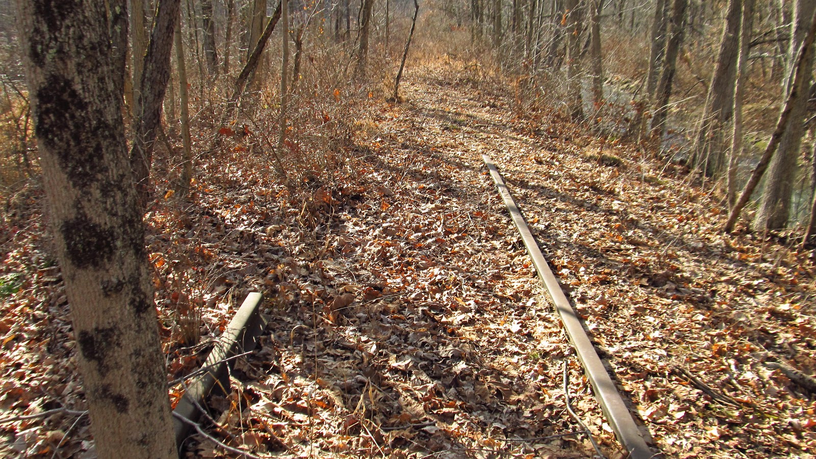
Sunday gave us a nice dry and sunny day. I had been noticing on trips to work in Irwin that there were some intact railroad tracks glimmering in the snow off of Route 993. I was aware that the tracks existed but never walked this section. I did the section coming in from Manor about five years ago when I posted about the Jimtown/Penn Manor No. 1 Coke Works. The tracks had been lifted in that section.
The Manor Valley Branch was an extremely important railroad that opened up the coal fields at Claridge and later McCullough. In 1885, the Pennsylvania Railroad began acquiring the properties along the right of way of the proposed branch. This branch would follow the east side of Brush and Bushy Run from the mainline at Manor to the Denmark Mine in Claridge. It was 2.3 miles from the mainline junction at Manor to Harrison City, and 1.9 miles from Harrison City to Claridge. There were stations at Manor, Harrison City, Claridge and one at Clark's Crossing, which was 1.2 miles past Harrison City and .7 miles before Claridge Station. The majority of the railroad's traffic were coal trains, but there was passenger service consisting of two round trips per day (except Sundays) between Claridge, Manor, and the points in between.
The freight and passenger station at Claridge was located in a large two story building that E.M. Gross and J. Howard Patton (a man that has been popping up repeatedly due to his Louise and Mt. Grey Mines) constructed as a general store. The Denmark Mine was located .4 miles from Claridge Station. It closed in 1932.
The station at Harrison City, we believe, was located in a small area between Route 130 and the second railroad bridge behind the Harrison City Fireman's Club. There are visible concrete pads where we believe the station was located.
Passenger service ended in 1927.
The McCullough Mine was opened in 1918 and a spur was built off the branch to serve this mine. McCullough was a Westmoreland Coal Company mine. It was eventually connected with the Export Mines and was used to drain all three mines. McCullough Mine closed in 1955.
The abandonment of the Manor Valley Branch is somewhat questionable. The 1964 PRR Form CT 4001 - Stations, Yards, and Sidings lists the branch from the mainline (Manor) and ending at Harrison City. A 1977 and 1981 Conrail chart has it extending 1.6 miles from Manor and ending at the old Westinghouse facility (modern day Ranbar) on Route 993. The railroad was intact to McCullough until at least 1983 and may have been used during the reclamation efforts of the mine site. In 1986, it's fate was definitely sealed. The railroad bridge at Manor collapsed onto Route 993 while undergoing demolition.
I found a full section of intact rail starting at Harrison City to the area of Howard Gasoline & Oil on Route 993. I also located miscellaneous sections of intact track the whole way up to Watt Road below the Penn Middle School across from the Giant Eagle shopping center at McCullough.
Manor Valley Branch and mining history borrowed from "History Of Penn Township" 1982, John W. Mochnick.
The following vintage photos are courtesy of http://digital.hagley.org/.

Denmark Mine 1889

Denmark Mine 1908

Denmark Mine 1889

Denmark Mine 1908

McCullough Mine during construction in 1918.


McCullough Mine during construction in 1918.

 |
McCullough Mine 1923 |

 |
Out of the two bridges behind the Harrison City Fireman's Club, this is the only one that's intact. |

 |
On top of the bridge. |
 |
Looking back at the fine bridge we just crossed. |
 |
Heading toward Manor. Through the land of ticks and jaggers. |


 |
Old hardware keeping these tracks aligned. |


 |
Interesting tree growth. |


 |
It's impossible to just "walk the tracks". Sections of this railroad are extremely overgrown. |

 |
Coming across another small bridge. This is crossing an unnamed tributary to Brush Creek. |
 |
Typical Pennsylvania Railroad railing. This is unstamped however. |


 |
Some erosion from Brush Creek. |


 |
One loose track. |

 |
And just like that, the rails end. |

 |
After the tracks end it's a pretty easy walk. |
 |
Behind Ranbar, the old Westinghouse. |
 |
Piles of railroad ties. |

 |
The Jimtown/Penn Manor No. 1 coke ovens. They haven't changed much. After this I walked back to Harrison City. |
 |
Section of track between the bridges. The fill for the Harrison City Fireman's Club is partially burying the track. |
 |
Switch before the next bridge. |


 |
Abutment for the missing bridge. Route 130 is on the other side of the garage at the top, middle of the photo. We believe Harrison City Station was located in this yard. More on that in a second... |

 |
The railroad would have passed through where this truck cap is sitting. |
 |
Another tree attacking the track. |
 |
OK, this is what we believe to be the concrete pads/piers for Harrison City Station. |

 |
There is a structure standing here on the section of pads. Maybe this was part of it. |
 |
Bushy Run running between the old bridge abutments. |
 |
Looking over at where the railroad crossed Route 130. |
 |
Some of the railroad grade on the other side of 130. |
 |
Intact track before Watt Road below the middle school. |

 |
Heading up Penny Lane. This is where the sidings would have started for the McCullough Mine. |
 |
The location of the tipple for the McCullough Mine. |
 |
Part of the reclaimed mine site. |
 |
Reclaimed, but still identifiable as, slate dump for the McCullough Mine. |
 |
A few of the patch houses in the Westmoreland Coal Company town of McCullough. |


 |
I think this was the company store. I am not positive though. |
Update 2/3/2018
Today we headed back out to McCullough to follow the rest of the railroad back to Harrison City. We also located and attempted to follow the branch into Claridge. It was way too overgrown, the tracks were pulled long ago, so we just caught back up with it in Claridge.
We started with the intact section off of Watt Road. It was nice going at first. Then it started getting overgrown. The highlight of this part of the branch is this old wooden bridge.
 |
The small wooden railroad bridge. |

 |
Even the abutments are wood. |


 |
Looking between the two main beams. |
 |
Looking toward Harrison City from the bridge. |
 |
The ties on top of the bridge were notched to fit inside the beams. |

 |
This is at the junction of the branch to Claridge and McCullough. Looking toward Harrison City. The grade on the left went to Claridge. The grade on the right, with the intact tracks, went to McCullough. |
 |
The woodpile, roughly center left, is the approximate location of the junction. |
 |
The McCullough tracks just end right here. |
 |
Looking north. Claridge branch on the right. McCullough on the left. |
 |
Claridge branch. Getting pretty thick. There are still ties down. |
 |
Looking south toward Harrison City on the Claridge branch. McCullough branch on the right. |
 |
At the junction. Back behind the houses is the grade. At the end of these houses is Route 130. |
 |
Miscellaneous track shots heading back to McCullough. |


 |
We really liked this old garage and gas station along the tracks. |


 |
Back side of the garage. Outhouse on the right. |

 |
Nice pink toilet seat inside the outhouse. |
Let's go to Claridge.
 |
The grade is on the other side of the creek. |
 |
The railroad crossed the road here on the other side of the guardrail and the speed limit sign. This is about where Watt Road becomes Main Street in Claridge. |
 |
Looking up Gombach Road. The railroad crossed here between the bridge and the speed limit sign. |
 |
The grade off Gombach Road looking toward Claridge. |
 |
The grade looking away from Claridge. Picture the big pile of dirt and the trailer gone. |
Denmark Mine
Of course we're not going to come to Claridge and not look around the mine site. Fish Fry's are a couple weeks away. We'll be in Claridge at Colton Hall quite a bit!
The Manor Gas Coal Company was organized February 7, 1884. The primary investors consisted of members of prominent area families, namely Kline, Coulter, and Huff. In 1884 Amos. B. Kline, acting for the Manor Gas Coal Company acquired the first 163 acres of coal lands at what would be Claridge. For the land tracts and mineral rights that he conveyed to the company, Kline received 9,000 shares, or 90% of the capital stock of the coal company. Within months of the organizing, the interests of Manor Gas Coal were acquired by the Westmoreland Coal Company. Under this arrangement, the Manor Gas Coal Company was able to operate the mine under their own name until 1917, when Manor Gas Coal and Penn Gas Coal were absorbed into the Westmoreland Coal Company. The Denmark Mine was the reason the Manor Valley Branch was built. In 1886, when the branch was completed, the honor of naming the mining village at Denmark Mine was given to Robert Pitcairn, the superintendent of the Western Division of the Pennsylvania Railroad. Pitcairn chose the name Claridge, for his ancestral birthplace in Scotland. The Denmark Mine closed on July 30, 1932 after nearly a half century of production.
 |
Part of a stone foundation can be seen behind the tires. |
 |
A wooden retaining wall surrounded this small raised area where we found a poured concrete foundation. |


 |
On one of the mine maps it mentions steel cable haulage. We found plenty of that. |
 |
Looking down toward where the tipple was located. Main Street Claridge is in the background. The mine entrance would be behind us. Past strip mining in that area has changed the landscape and the entrance is not possible to locate. |
 |
More steel cable. |
 |
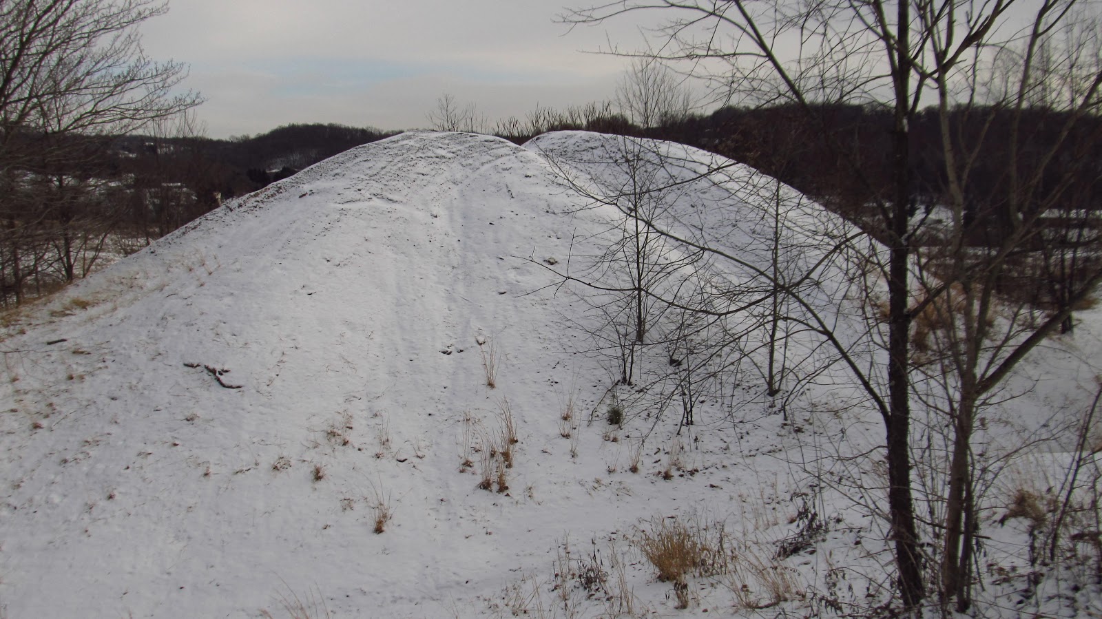
The huge slate dump behind the mining site. We have a theory that the other mines that were located at Claridge also dumped here. It's a huge area. But after nearly 50 years of mining, it is quite possible that this could all be from the Denmark. |

 |
Somebody tried driving up this. They failed. |
 |
This whole area is a slate dump, behind a slate dump, behind a slate dump. It goes on and on. Mountains of historic mine waste. |


 |
We found this nice passageway that led us to the top of the heap. |


 |
Looking down at Claridge. |

 |
Looking down from the hill that the guy tried driving up. |

 |
My partner in crime, Lou, looking down on Claridge. Literally. He's got nothing against Claridge. |

 |
This is the poured concrete foundation we found. This building is not identified on the mine maps. |
 |
Window wells from the building. These and the poured concrete lend to our theory that this was not one of the original buildings from the beginning of the mine. |
 |
Pipe sticking out of the ground. |
 |
These are abutments along the creek. We thought they might have been tipple related but the an early mine map shows a road crossing here. |

 |
There is more steel cable here. |
 |
On the western bank of the creek there are huge pieces of concrete. |
 |
Portion of one of the mine maps showing the outside workings of the Denmark Mine. The small building to the right of the power house is the foundation that we found. |
 |
Lower section of the mine map showing the track alignment. Also noted on this map is the bridge for the abutments we saw. |