This is a quick post of these two sites. There's not a lot left at either of them, but what is left is noteworthy. None of the coke ovens related to either of these sites are extent but we do have a couple buildings and a restored (though sealed) slope portal.
Both of these locations are historically significant in different ways. The Mammoth Mine was the site of a huge mine explosion in 1891 which claimed the lives of 116 miners. This was the largest mine disaster in Westmoreland County until the 1907 Darr Mine explosion claimed 239 miners.
Standard Shaft once boasted the largest coke works in the United States, and according to some accounts I've seen, the world. At its heyday it contained over 900 ovens.
Mammoth No. 2
In 1879, 2,000 acres of coal property in Mount Pleasant Township were purchased by Col. J.W. Moore of Greensburg. In 1885 his company opened the slope mine. The following year saw the opening of a shaft mine just west of the slope. Both mines had their own coke works and totaled 377 ovens at this time.
In August 1889, the Mammoth property was purchased by the H.C. Frick Coke Company. Frick operated the mines for a little over a year before the 1891 explosion. About one year after the explosion, the company repaired the underground works and reopened the slope mine.
By 1910, the slope mine (No. 2) had 199 ovens and the shaft (No. 1) had 311. Although the slope mine was the first of the two, it was named Mammoth No. 2 by Frick. Frick operated the mine and coke works until 1927 but leased the coke works in the 1930's to a Greensburg operation. The ovens near No. 1 remained in use until around 1946.
Nothing remains of the coke works and the only remaining building (besides the former company houses), is the former Boiler and Lamp House Building. This building currently houses the offices for Mount Pleasant Township.
 |
| The slope entry for the No. 2 mine. |
 |
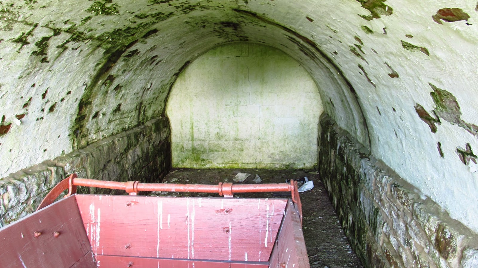
| Inside the sealed slope entry is an old mine cart. |
 |
| Inside the cart. |
 |
| A closer look in the portal. |
 |
| I'm guessing this is a brake lever. |
 |
| It's attached to the brakes. |
 |
| A dedication to the miners who died in the explosion. |
 |
| The area of the portal and the monument. |
 |
| The current municipal offices and former Lamp/Boiler House. |


Standard Shaft
Standard Shaft No. 2 was opened by the H.C. Frick Coke Company in 1886. It was one of the largest mines and coke works in the United States. The village of Standard Shaft was built after the original coal patch of Standard, which straddles Rt. 819 just north of Mt. Pleasant. Both of these communities are largely intact today. The greatest year of production at Standard Shaft was 1918. That year saw 790,000 tons of coal removed from its mine.
Coal production wavered throughout the rest of the mines life. In 1925 the mine produced more than 630,000 tons of coal and the coke works produced over 253,000 tons of coke. In 1930 the mine produced over 500,000 tons of coal. In 1931 the mine and coke works were closed.
Other than the houses and the two mine buildings, nothing remains of this enormous operation.
For the record, I think Standard Shaft looks like a really nice, quiet place to live. Everybody I met who lives there has been very polite and seem to look out for each other. The houses are well kept, the neighborhood is spotless and there are many gardens to be jealous of.
This is just a very brief history of standard shaft. A much more in depth history can be found here: http://patheoldminer.rootsweb.ancestry.com/standshaft.html
 | ||
| This is an old postcard I own of the Standard Shaft coke works. |
 | ||
| A nice historical sign as you enter Standard Shaft. |
 |
| This is the Standard Shaft Boiler House. This is an original building from the opening of the mine. |
 |
| One of the patch houses is visible behind the Boiler House. |


 |
| These small sections of railroad track are all I could find out of what must have been a huge amount of track. |
 | ||
| They are located outside of the Compressor House. |
 |
| This is the Compressor House. I'm sure the garage doors were added later. |
 |
| One of the windows. |
 |
| It must be privately owned. Somebody is taking care of it. |

 |
| There were four of these "hooks" running down the side of the building. I'm not sure what they were used for. |


 |
| This was sticking out of the ground. Two pieces of track. |

 |
| This was hanging out of the side. |
 |
| An overall view of the two buildings. There are other foundation remains also visible. Again, these buildings must be privately owned. I would think when the area was reclaimed, these buildings would have went too. |
 | |
| Old photo of Mammoth Coke Works (The Engineering Magazine, October 1901) |

Old photo of Standard Shaft (The Engineering Magazine 1901)
 |
| Coke drawers at the Mammoth Works (Engineering Magazine 1901) |


