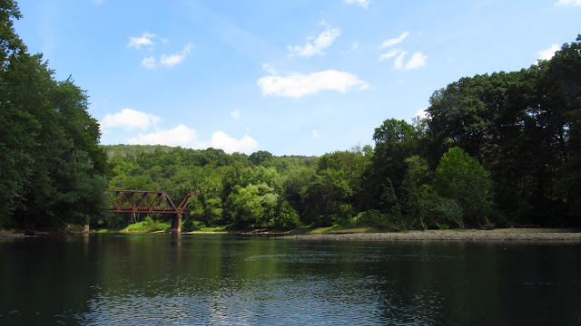
With summer coming to a close soon, today was a perfect day to get out on the water. I rented a kayak, launched at Avonmore and pulled out at Apollo. I had been through this section before and remembered seeing a few canal ruins. I thought today would be a good day to enjoy being on the water and taking a closer look at the ruins. I ended up stopping a lot because I just kept coming across possible remnants. There are a lot out there.
 |
| Starting off in Avonmore. Heading towards the old 1883 Western Pennsylvania Railroad Piers. |
 |
| I know they're not part of the canal but bear with me. They do play an important part in differentiating what was railroad and what was canal. |
 |
| The abutment opposite of the tunnel. More information on this bridge and the tunnel can be found here. |
 |
| However, with the river low, you can still see the wooden forms that were used in constructing these piers. |
 |
| As well as the foundation of the piers. It's really nice seeing such clear water on the Kiski River. |
 |
| So heading down toward the 1950's alignment bridge we find the first remnant of the canal. |
 |
| At the far right of this photo is the mouth of Long Run. After only being on the water for 15 minutes I already found my first canal remnant. |
 |
| We know that between the guard lock at Roaring Run and Saltsburg there were four lift locks. Maybe this is part of one of them? |
 |
| There's not a whole lot left but it's definitely something worth taking note of. |
 |
| Looking up Long Run. There is a lot of considerably deeper (maybe 4 ft.) slack water all through this section. These appeared anytime the water was extremely shallow or there were rapids. |
 |
| Looking across Long Run at the other side. No indication of anything here. |
 |
| Back on the water. Heading towards the current railroad bridge. |
 |
| After this it was smooth sailing. Just slow moving water and a lot of paddling. |
 |
| After I got through the rapids I pulled over along the side and started walking back upstream. Please note that the order of these photos is heading upstream. |
 |
| These walls were around twelve feet tall. |
 |
| The wall ran the entire length of the rapids. The canal would have certainly been on the shore in this section. I'm thinking maybe this was built to protect the canal? |
 |
| Looking upstream toward the Salina Bridge. The rapids aren't bad but you couldn't navigate a canal boat through them. |
 |
| More wall. |
 |
| There are similar walls to these along the Conemaugh through Packsaddle Gap. |
 |
| The wall lasted for quite a while. There are a few more of these further downstream. |
 |
| Another shot of the river in this section. |
 |
| This is what I noticed as soon as I hit the rapids. Right before the Salina Bridge. |
 |
| Another one of the locks? |
 |
| This one is in much better condition than the one closer to Avonmore. |
 |
| Walking back to my kayak. |
 |
| A final shot of this wall. |
 |
| Back on the water. |
 |
| Lots of slack water. |
 |
| This is at the next set of rapids. Nothing intact but possibly canal related. |
 |
| This is a decent ways inland. |
 |
| Looking toward the river from this section I was exploring. My kayak on the bank. |
 |
| A little further down. Another section of wall. |
 |
| Looking over at the wall from the river. This was in a very shallow section. |
 |
| More slack water. Roaring Run Trail toward the center. Apparently the trail is built on the old towpath. |
 |
| Another small section of wall. It would be interesting to see all this when the vegetation is gone. It would not be interesting being on this water in the cold though. |
 |
| A little more wall. The Roaring Run Trail is in the background. |
 |
| Looking up Roaring Run. Apparently there are remains of an aqueduct here but it would be easier to access from the trail. |
 |
| Right before pull out. |


Awesome Mike!
ReplyDeleteWas not aware so much of the old West Penn Canal was still visible. Neat finds. Helps with summer low water too.
Eric Johnson
Hey Eric! I was surprised how much was out there too. I think I passed over wooden forms for a dam too. I couldn't get back there though,
DeleteYour continued documentation of Pa Industrial history great appreciated! That concrete Bridge abutment is awesome. God bless all those hard working workers from back than,just incredible craftsmanship!
ReplyDeleteYou're welcome Patricia. Thanks for looking!
ReplyDeleteVery interesting, especially since I had grown up in that area and spend much time on the Kiski. Your info gives a greater appreciation.
ReplyDeleteWhat a nice view of everything, it was like we were right in the water with you. How on Earth did they get the stone cut, that had to be a hard job with a lot of muscle.
ReplyDeleteThat stone was cut by drilling holes into it and then pounding it to get it to split. It had to be a lot of work but those guys were expert masons.
DeleteLove this. Great exploration of my area. We took the same paddle trip a few years back. Saw a bald eagle. If I can add the video I shot some may see exactly what you speak of. https://www.youtube.com/watch?v=QfPLWNi24Yw&t=2s
ReplyDelete