Saturday, March 16, 2013

Off of the West Penn Trail Saltsburg Section


This is part of the original Pittsburgh to Harrisburg Main Line Canal past White Station. This is the only part of the canal that I know of that still contains water. Further up you can still find old ruins of the canal. The old tow path is easy to locate and you can follow it for a good distance. After the canal ruins, you come across an old mine site. This was part of a coal preparation plant for the old Bowman No. 2 mine on the Westmoreland County side of the river. The coal was brought across the river via an aerial tramway. The tipple and pit mouth were located just across the river from here in the old coal town of Robinson, PA


A foundation for one of the preparation plant buildings.


Old ruins of the tipple on a siding off the mainline. The coal was loaded from here onto trains after it was cleaned.


Old tipple pillars.


Beyond the mine site and across Elders Run is this old railroad bridge. The current trail goes across this bridge and it is difficult to even recognize that you are on a bridge while on the trail.


This is on the back side of the bridge.

This is a portion of the old mine map for Bowman No. 2 showing the tramway, pit mouth, and tipple on the Westmoreland County side. The cleaning/preparation plant as well as the Elders Run bridge can be seen on the Indiana County Side. Below is the area over the modern map.


Beyond this there are a few buildings from some sort of industrial site. I heard that it was an old powder works but I'm not sure if that's accurate. The steel doors on the buildings sort of lend to that theory.


One of the big steel doors.


Beyond this is the switchback that goes back to the Conemaugh Dam recreation area and beyond that is the Bow Ridge Tunnel and the numerous stone arch bridges leading to Blairsville.


Beyond this tunnel begins the switchback on the Dick Mayer section of the trail.

July 18, 2014

A little update on this post. 


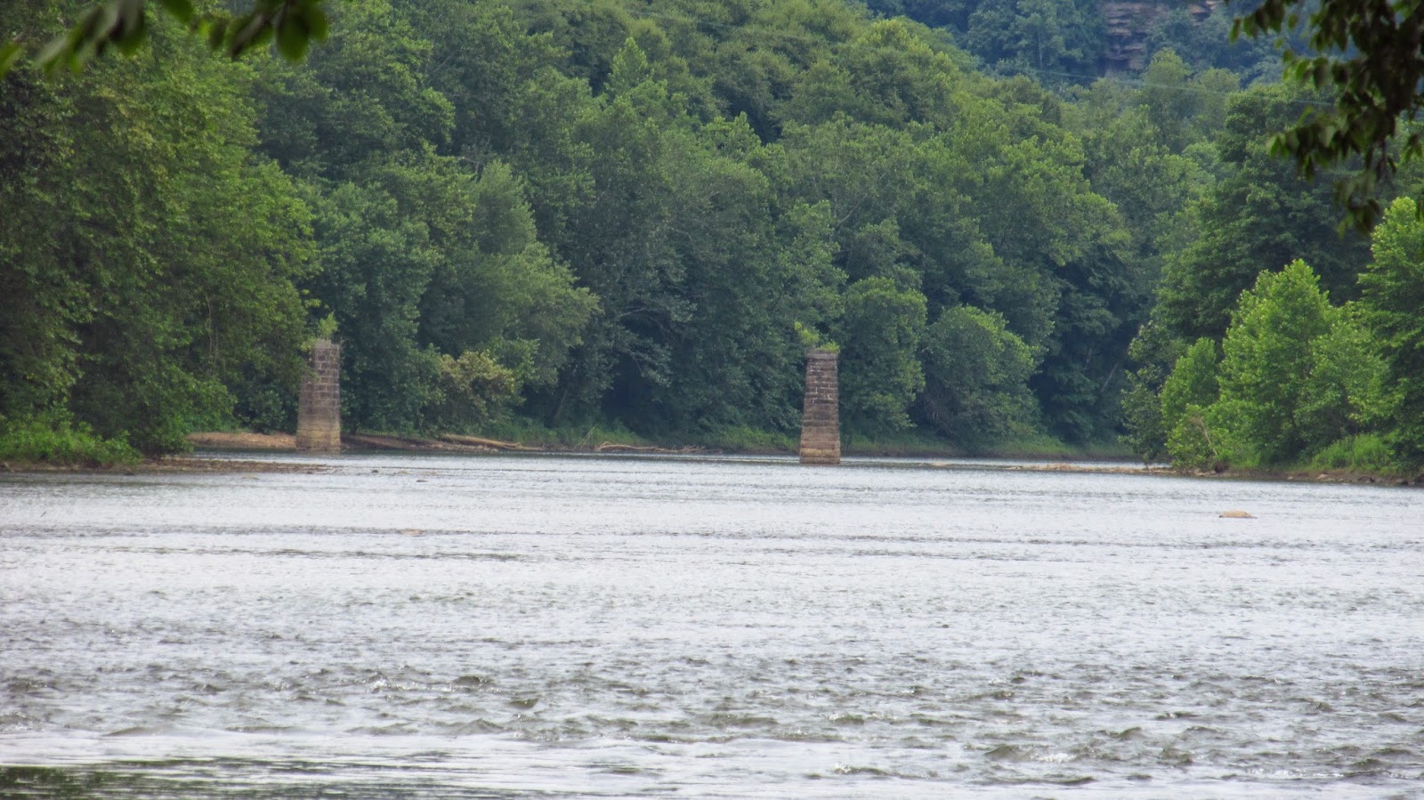
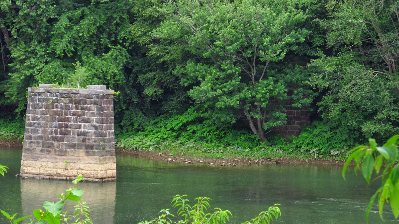
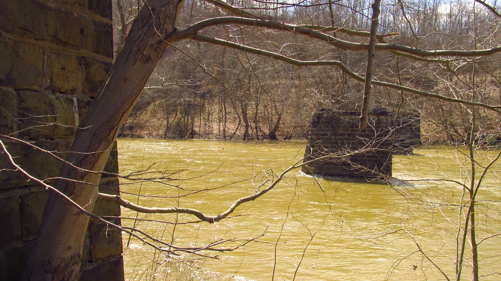
These are bridge piers from the Mooween Mine.


 The mine itself was located on the Westmoreland County side of the river.


 The tipple was located on the Indiana County side because that's where the railroad was.

 The coal was shipped across the river over a bridge located on top of these piers. 

The Mooween Mine began in 1906 and was in operation until ca. 1950. The operators throughout the mines life were the Keystone Coal Company of Moween, PA.


 Here we see a portion of the old Main Line Canal. On the left is the canal, on the right is the towpath.


This section still contains water (and a whole lot of frogs).


Update 4/11/15

 A couple more photos of the Moween Mine piers. A great day to view them before all the vegetation grows back. 


 This masonry work is still so tight. Incredible.


Also, the canal was really standing out today.


With the spring storms there was a lot of water in the canal. It really made it a unique experience.


And the creatures are coming back out too!!


4 comments:

  1. Cool pics. I grew up about 5-10 minutes walking distance from the canal(where the water is). As kids, we played in the ruins (most torn down now). Lots of great memories.

    ReplyDelete